
IMAGES TAKEN NEAR TO
Hallowmoor Road, SHEFFIELD, S6 4WW
Introduction
This page details the photographs taken nearby to Hallowmoor Road, S6 4WW by members of the Geograph project.
The Geograph project started in 2005 with the aim of publishing, organising and preserving representative images for every square kilometre of Great Britain, Ireland and the Isle of Man.

There are currently over 7.5m images from over14,400 individuals and you can help contribute to the project by visiting https://www.geograph.org.uk
Image Map
Images are licensed for reuse under creativecommons.org/licenses/by-sa/2.0
Notes
- Clicking on the map will re-center to the selected point.
- The higher the marker number, the further away the image location is from the centre of the postcode.
Image Listing (31 Images Found)
Images are licensed for reuse under creativecommons.org/licenses/by-sa/2.0
Image
Details
Distance
1

Loxley Motors, Malin Bridge, Sheffield - 1
Loxley Motors is based in the former St Marks Methodist Chapel ... St Marks was opened in 1834 and enlarged in 1870, and again in 1898. A replacement Chapel was opened in, nearby, Dykes Lane in 1904 ... and this building was then used as a Sunday School for a number of years. Eventually the Sunday School also moved to new premises and the Chapel was sold off. Image
Image: © Terry Robinson
Taken: 14 Jan 2009
0.16 miles
2
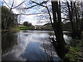
Mill pond, Wisewood
Looking towards the dam of the millpond for Wisewood Forge. The buildings are a new housing development and replace those of the former forge. Wisewood Forge consisted of two separate mills, the forge itself and, downstream of it, a rolling mill.
Image: © Rudi Winter
Taken: 5 Apr 2012
0.16 miles
3
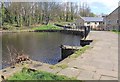
Wisewood Forge Dam
This is the mill pond and dam off the River Loxley, from the old Wisewood Forge and Wisewood Forge Rolling Mill. In the foreground can be seen where the paddles would have regulated the flow of water down the head race to the water wheels. The site was the subject of an archaeological investigation when the Loxley Park Retirement Home was built, part of which can be seen on the right of the picture. Some more information and a picture (Figure 9. Excavations at Wisewood Forge) can be seen here http://www.hrionline.ac.uk/matshef/symonds/MSsym.htm Taken during the Geograph Conference 2012 second guided walk.
Image: © David P Howard
Taken: 5 Apr 2012
0.16 miles
4
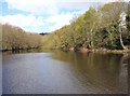
Wisewood Forge mill pond
This is the mill pond off the River Loxley, from the old Wisewood Forge and Wisewood Forge Rolling Mill. Taken during the Geograph Conference 2012 second guided walk.
Image: © David P Howard
Taken: 5 Apr 2012
0.17 miles
5

Mill Pond at Wisewood
The dammed water powered a forge and a rolling mill at Wisewood.
Image: © Anne Burgess
Taken: 5 Apr 2012
0.18 miles
7

Honeysuckle Cottage, Loxley Road, Malin Bridge, Sheffield
I presume that there is some, somewhere nearby!
Image: © Terry Robinson
Taken: 14 Jan 2009
0.18 miles
8
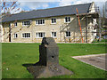
Drop forge anvil, Wisewood Forge site
The Wisewood Forge site has been recently redeveloped for housing. Ever since the Byker in the mid-1970s Image it has become standard practice to incorporate features and materials from a site into the successor development. They acknowledge the past and create a connection with it. In contrast with another forge anvil placed in a formal setting and thereby given significance, this example, sadly, is merely incongruous.
Image: © Robin Stott
Taken: 5 Apr 2012
0.18 miles
9
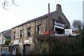
Loxley Motors, Malin Bridge, Sheffield - 2
As seen in this view, the former Chapel was a two-storey building, with access to the upper level from Wisewood Lane, and access to the lower levels from Loxley Road. Image
Image: © Terry Robinson
Taken: 14 Jan 2009
0.18 miles
10
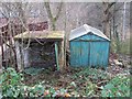
Disused Garages, Loxley Road, Malin Bridge, Sheffield
Image: © Terry Robinson
Taken: 14 Jan 2009
0.19 miles