
IMAGES TAKEN NEAR TO
Portsea Road, SHEFFIELD, S6 4QB
Introduction
This page details the photographs taken nearby to Portsea Road, S6 4QB by members of the Geograph project.
The Geograph project started in 2005 with the aim of publishing, organising and preserving representative images for every square kilometre of Great Britain, Ireland and the Isle of Man.

There are currently over 7.5m images from over14,400 individuals and you can help contribute to the project by visiting https://www.geograph.org.uk
Image Map
Images are licensed for reuse under creativecommons.org/licenses/by-sa/2.0
Notes
- Clicking on the map will re-center to the selected point.
- The higher the marker number, the further away the image location is from the centre of the postcode.
Image Listing (66 Images Found)
Images are licensed for reuse under creativecommons.org/licenses/by-sa/2.0
Image
Details
Distance
1
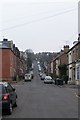
Hawthorn Road, Hillsborough, Sheffield
Image: © Terry Robinson
Taken: 19 Mar 2009
0.08 miles
2
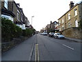
Dykes Hall Road, Sheffield
Looking north west up the hill.
Image: © JThomas
Taken: 21 Mar 2019
0.09 miles
4
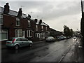
Dykes Hall Road,Hillsborough
Looking down hill on a wet morning, past the chemist shop and Medical Centre.
Image: © Peter Barr
Taken: 10 Oct 2011
0.10 miles
5
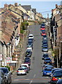
Oakland Road, Malin Bridge
Sheffield abounds in steep roads like this; the use of a telephoto lens emphasises the steepness.
Image: © Alan Murray-Rust
Taken: 5 Apr 2012
0.11 miles
6
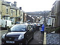
View down Oakland Road towards Holme Lane
Image: © Roger Templeman
Taken: 3 Feb 2011
0.11 miles
7
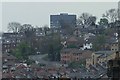
The Arts Tower from Wadsley, Sheffield
The road climbing the hill is Walkley Lane ... with the top of the University Arts Tower in the background. Image
Image: © Terry Robinson
Taken: 30 Apr 2008
0.11 miles
8
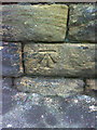
Benchmark on wall opposite #167 Dykes Hall Road
Ordnance Survey cut mark benchmark described on the Bench Mark Database at http://www.bench-marks.org.uk/bm36718
Image: © Roger Templeman
Taken: 2 Feb 2011
0.15 miles
9
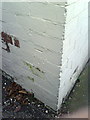
Benchmark on the south side of Minto Road Dental Care
Ordnance Survey cut mark benchmark described on the Bench Mark Database at http://www.bench-marks.org.uk/bm36704
Image: © Roger Templeman
Taken: 2 Feb 2011
0.15 miles
10
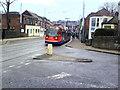
Supertram 104 passes Minto Road Dental Care on Middlewood Road
The road junction is Middlewood Road and Minto Road (right).
Image: © Roger Templeman
Taken: 2 Feb 2011
0.16 miles