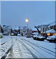
IMAGES TAKEN NEAR TO
Millrace Drive, ROTHERHAM, S63 9BW

Introduction

This page details the photographs taken nearby to Millrace Drive, S63 9BW by members of the Geograph project.

The Geograph project started in 2005 with the aim of publishing, organising and preserving representative images for every square kilometre of Great Britain, Ireland and the Isle of Man.

There are currently over 7.5m images from over14,400 individuals and you can help contribute to the project by visiting https://www.geograph.org.uk

Image Map


Images are licensed for reuse under creativecommons.org/licenses/by-sa/2.0
Notes
  • Clicking on the map will re-center to the selected point.
  • The higher the marker number, the further away the image location is from the centre of the postcode.

Image Listing (5 Images Found)

Images are licensed for reuse under creativecommons.org/licenses/by-sa/2.0
Image
Details
Distance
1
Speed camera.
Image: © Steve Fareham Taken: 25 Aug 2007
0.08 miles
2
Football pitches, Bolton upon Dearne
These playing fields are beside Dearne Carrfield Primary School. Beyond Highgate Lan, which runs past the far side of the fields, are closes of houses between Bolton upon Dearne and Goldthorpe. View from a train on the railway line between the two stations.
Image: © Derek Harper Taken: 6 Apr 2012
0.14 miles
3
Goldthorpe - cricket pitch
Dearne Miners Welfare Ground is the home of Dearne Cricket Club (see http://dearne.play-cricket.com/home/aboutUs.asp for more details).
Image: © Dave Bevis Taken: 8 Jun 2013
0.22 miles
4
Cranwell Court in the snow
Image: © Steve Fareham Taken: 21 Jan 2013
0.23 miles
5
Skipit!
Image: © Steve Fareham Taken: 25 Nov 2007
0.24 miles