IMAGES TAKEN NEAR TO
High Street, ROTHERHAM, S63 0SU
Introduction
This page details the photographs taken nearby to High Street, S63 0SU by members of the Geograph project.
The Geograph project started in 2005 with the aim of publishing, organising and preserving representative images for every square kilometre of Great Britain, Ireland and the Isle of Man.

There are currently over 7.5m images from over14,400 individuals and you can help contribute to the project by visiting https://www.geograph.org.uk
Image Map
Images are licensed for reuse under creativecommons.org/licenses/by-sa/2.0
Notes
- Clicking on the map will re-center to the selected point.
- The higher the marker number, the further away the image location is from the centre of the postcode.
Image Listing (13 Images Found)
Images are licensed for reuse under creativecommons.org/licenses/by-sa/2.0
Image
Details
Distance
1
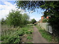
Footpath to High Street, Thurnscoe
Image: © Jonathan Thacker
Taken: 26 Apr 2018
0.13 miles
2
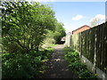
Footpath to High Street, Thurnscoe
Image: © Jonathan Thacker
Taken: 26 Apr 2018
0.13 miles
3
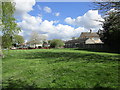
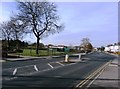
Open space off Derry Grove, Thurnscoe
Image: © Jonathan Thacker
Taken: 26 Apr 2018
0.16 miles
4
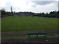
Houghton Road in Thurnscoe
Hickleton Bowling Club can be seen on the left of picture.
Image: © Jonathan Clitheroe
Taken: 12 Nov 2015
0.19 miles
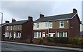
5
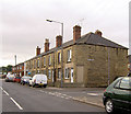
Togo Street Thurnscoe.
Why was this named Togo buildings?
Image: © Steve Fareham
Taken: 5 Sep 2007
0.20 miles
6
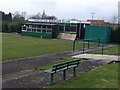
Bowling green, Hickleton Bowling Club,Thurnscoe
Image: © JThomas
Taken: 9 Feb 2013
0.20 miles
8
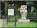
Go Wild in Thurnscoe Sculptures - Owl
One of a series from 2019.
Image: © JThomas
Taken: 19 Sep 2022
0.22 miles
9
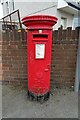
Elizabeth II postbox on Houghton Road
Postbox No. S63 180.
Image: © JThomas
Taken: 19 Sep 2022
0.23 miles