IMAGES TAKEN NEAR TO
Low Grange Square, ROTHERHAM, S63 0LF
Introduction
This page details the photographs taken nearby to Low Grange Square, S63 0LF by members of the Geograph project.
The Geograph project started in 2005 with the aim of publishing, organising and preserving representative images for every square kilometre of Great Britain, Ireland and the Isle of Man.

There are currently over 7.5m images from over14,400 individuals and you can help contribute to the project by visiting https://www.geograph.org.uk
Image Map
Images are licensed for reuse under creativecommons.org/licenses/by-sa/2.0
Notes
- Clicking on the map will re-center to the selected point.
- The higher the marker number, the further away the image location is from the centre of the postcode.
Image Listing (15 Images Found)
Images are licensed for reuse under creativecommons.org/licenses/by-sa/2.0
Image
Details
Distance
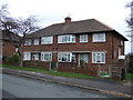
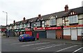
1
Boarded up housing
There are a significant number of unoccupied houses in this part of Thurnscoe.
Image: © Steve Fareham
Taken: 28 Oct 2007
0.11 miles
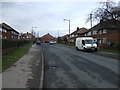
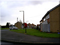
2
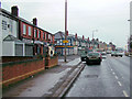
Thurnscoe
Taken on the B6411 on the main road through Thurnscoe
Image: © Richard Spencer
Taken: 5 Feb 2006
0.14 miles
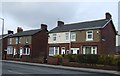
3
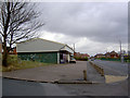
Open or closed
I'm not sure if this shop was open or closed on Merrill Road Thurnscoe.
Image: © Steve Fareham
Taken: 2 Dec 2007
0.16 miles
4
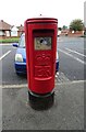
Elizabeth II postbox on Houghton Road
Outside the Post Office.
Postbox No. S63 157.
Image: © JThomas
Taken: 19 Sep 2022
0.17 miles
5
Post Office and shops on Houghton Road
Showing position of Postbox No. S63 157.
Image: © JThomas
Taken: 19 Sep 2022
0.17 miles
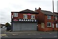
6
Post box in regeneration area
Lingamoor leys Thurnscoe.
Image: © Steve Fareham
Taken: 2 Dec 2007
0.20 miles