IMAGES TAKEN NEAR TO
Albion Drive, ROTHERHAM, S63 0BA
Introduction
This page details the photographs taken nearby to Albion Drive, S63 0BA by members of the Geograph project.
The Geograph project started in 2005 with the aim of publishing, organising and preserving representative images for every square kilometre of Great Britain, Ireland and the Isle of Man.

There are currently over 7.5m images from over14,400 individuals and you can help contribute to the project by visiting https://www.geograph.org.uk
Image Map
Images are licensed for reuse under creativecommons.org/licenses/by-sa/2.0
Notes
- Clicking on the map will re-center to the selected point.
- The higher the marker number, the further away the image location is from the centre of the postcode.
Image Listing (18 Images Found)
Images are licensed for reuse under creativecommons.org/licenses/by-sa/2.0
Image
Details
Distance
1
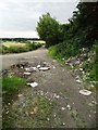
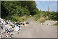
At the end of Chapel Lane, Thurnscoe East
Sadly, a haunt of anti-social flytippers.
Image: © Neil Theasby
Taken: 23 Jul 2015
0.12 miles
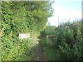
3
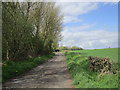
Chapel Lane
Primarily functions as access to Stotfold but unfortunately also seems to be a favourite of fly-tippers.
Image: © Jonathan Thacker
Taken: 26 Apr 2018
0.12 miles
6
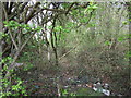
Is this the Barnsley Boundary Walk?
Well, no, though OS mapping implies that it is. The Barnsley Boundary Walk leaflet however puts the walk heading north at SE 4658 0543.
Image: © Jonathan Thacker
Taken: 26 Apr 2018
0.13 miles
7
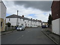
George Street, Thurnscoe East
Once stood in the shadow of Hickleton Colliery but that has long since been demolished and the spoil heap landscaped and transformed in Phoenix Park.
Image: © Jonathan Thacker
Taken: 26 Apr 2018
0.14 miles
8

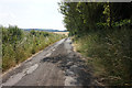
Chapel Lane
Blocked in two places to prevent vehicle access (and fly-tipping).
Image: © Jonathan Thacker
Taken: 26 Apr 2018
0.15 miles