
IMAGES TAKEN NEAR TO
Kirkstone Road, SHEFFIELD, S6 2PN
Introduction
This page details the photographs taken nearby to Kirkstone Road, S6 2PN by members of the Geograph project.
The Geograph project started in 2005 with the aim of publishing, organising and preserving representative images for every square kilometre of Great Britain, Ireland and the Isle of Man.

There are currently over 7.5m images from over14,400 individuals and you can help contribute to the project by visiting https://www.geograph.org.uk
Image Map
Images are licensed for reuse under creativecommons.org/licenses/by-sa/2.0
Notes
- Clicking on the map will re-center to the selected point.
- The higher the marker number, the further away the image location is from the centre of the postcode.
Image Listing (108 Images Found)
Images are licensed for reuse under creativecommons.org/licenses/by-sa/2.0
Image
Details
Distance
1
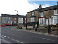
Bonnie and Clyde's
Former hairdressing business on Walkley Lane, Sheffield, which may have closed in a hail of bullets (for non-film buffs, it was a 1967 film about a couple who take to crime during the Great Depression in the USA and come to a sticky end).
Image: © Peter Barr
Taken: 12 Oct 2010
0.01 miles
2
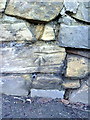
Benchmark on the wall opposite #43 Morley Street
Ordnance Survey cut mark benchmark described on the Bench Mark Database at http://www.bench-marks.org.uk/bm36738
Image: © Roger Templeman
Taken: 3 Feb 2011
0.05 miles
3
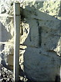
Benchmark on the roadside wall outside #151 Walkley Lane
Ordnance Survey cut mark benchmark described on the Bench Mark Database at http://www.bench-marks.org.uk/bm36736
Image: © Roger Templeman
Taken: 3 Feb 2011
0.05 miles
4
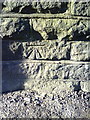
Benchmark on roadside wall of #189 Walkley Lane
Ordnance Survey cut mark benchmark described on the Bench Mark Database at http://www.bench-marks.org.uk/bm36737
Image: © Roger Templeman
Taken: 3 Feb 2011
0.07 miles
5
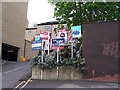
For Sale or To Let, near Stony Bank, Walkley
The number of signs here would put me off!
Image: © Terry Robinson
Taken: 3 May 2010
0.11 miles
6
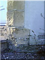
Benchmark on #103 Walkley Lane
Ordnance Survey cut mark benchmark described on the Bench Mark Database at http://www.bench-marks.org.uk/bm32673
Image: © Roger Templeman
Taken: 3 Feb 2011
0.11 miles
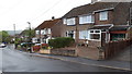
9
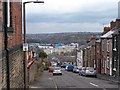
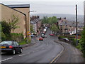
Lister Road, Walkley, Sheffield
In the distance you can see the rear of Regent Court Flats, the former Bassett's Factory (recently Cadbury's, now Kraft) ... and in the far distance Shirecliffe and Parson Cross. The side wall of the Sportsman Inn is on the left side of the picture ... this is the sort of view that can be seen from its rear windows ... Image
Image: © Terry Robinson
Taken: 7 Apr 2010
0.15 miles
10

Towsure ... The Outdoor Superstore, Holme Lane, Hillsborough, Sheffield
World famous for supplying 'Everything For The Greeat Outdoors' ... the 'Now Open' statement relate to the fact that the store had to close for many months following flooding in the area in July 2007. The River Loxley flows immediately behind the building on its way to join the River Don at Hillfoot. Image Image
Image: © Terry Robinson
Taken: 1 Nov 2008
0.15 miles