
IMAGES TAKEN NEAR TO
Limbrick Close, SHEFFIELD, S6 2PF
Introduction
This page details the photographs taken nearby to Limbrick Close, S6 2PF by members of the Geograph project.
The Geograph project started in 2005 with the aim of publishing, organising and preserving representative images for every square kilometre of Great Britain, Ireland and the Isle of Man.

There are currently over 7.5m images from over14,400 individuals and you can help contribute to the project by visiting https://www.geograph.org.uk
Image Map
Images are licensed for reuse under creativecommons.org/licenses/by-sa/2.0
Notes
- Clicking on the map will re-center to the selected point.
- The higher the marker number, the further away the image location is from the centre of the postcode.
Image Listing (149 Images Found)
Images are licensed for reuse under creativecommons.org/licenses/by-sa/2.0
Image
Details
Distance
1

Towsure ... The Outdoor Superstore, Holme Lane, Hillsborough, Sheffield
World famous for supplying 'Everything For The Greeat Outdoors' ... the 'Now Open' statement relate to the fact that the store had to close for many months following flooding in the area in July 2007. The River Loxley flows immediately behind the building on its way to join the River Don at Hillfoot. Image Image
Image: © Terry Robinson
Taken: 1 Nov 2008
0.06 miles
2
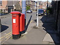
Oakland Road postbox (ref. S6 318)
A very clean example of an EVIIR pillar box. Clearly all the old paint was stripped back before repainting, so the casting details are all very crisp. It has a large drop box attached.
Image: © Alan Murray-Rust
Taken: 5 Apr 2012
0.06 miles
3
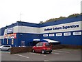
Towsure ... Holme Lane, Hillsborough, Sheffield
Image: © Terry Robinson
Taken: 2 Nov 2008
0.06 miles
4
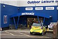
Towsure ... The HAP 1E Superstore, Holme Lane, Hillsborough, Sheffield
Image: © Terry Robinson
Taken: 2 Nov 2008
0.06 miles
5
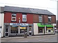
Fries and Fires, Holme Lane, Hillsborough, Sheffield
Note the 'overhanging' second floor over the corner entrance door of the Fireplace Shop ... this was possible by using metal columns in the structure. The columns are visible in this picture of a demolished shop on the opposite side of Holme Lane. Image
Image: © Terry Robinson
Taken: 19 Mar 2009
0.07 miles
6
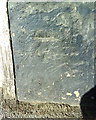
Benchmark on #78 Holme Lane
Ordnance Survey cut mark benchmark described on the Bench Mark Database at http://www.bench-marks.org.uk/bm36739
Image: © Roger Templeman
Taken: 3 Feb 2011
0.07 miles
7
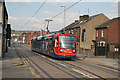
Sheffield supertram approaching Malin Bridge terminus
This shows the latest Stagecoach livery for Supertram for comparison with Stephen McKay's photo Image taken 10 years earlier which shows the original livery.
There appear to be differences of opinion regarding the spelling of Malin Bridge. Despite the OS map, I have always seen it as two words! (But I am not local to the area)
Image: © Alan Murray-Rust
Taken: 5 Aug 2007
0.07 miles
8
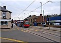
Sheffield Supertram No. 102 near junction of Holmes Lane and Ball Road
The tram is approaching the Malin Bridge terminus. Image
Image: © P L Chadwick
Taken: 12 Apr 2009
0.07 miles

10
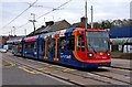
Sheffield Supertram No. 102 in Holme Lane (closeup)
The system is run by Stagecoach and the 25 strong fleet of German built Duewag trams are now in the latest Stagecoach livery. This one is near the Malin Bridge terminus.
Image: © P L Chadwick
Taken: 12 Apr 2009
0.08 miles