IMAGES TAKEN NEAR TO
S60 8EN
Introduction
This page details the photographs taken nearby to S60 8EN by members of the Geograph project.
The Geograph project started in 2005 with the aim of publishing, organising and preserving representative images for every square kilometre of Great Britain, Ireland and the Isle of Man.

There are currently over 7.5m images from over14,400 individuals and you can help contribute to the project by visiting https://www.geograph.org.uk
Image Map
Images are licensed for reuse under creativecommons.org/licenses/by-sa/2.0
Notes
- Clicking on the map will re-center to the selected point.
- The higher the marker number, the further away the image location is from the centre of the postcode.
Image Listing (22 Images Found)
Images are licensed for reuse under creativecommons.org/licenses/by-sa/2.0
Image
Details
Distance
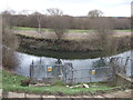
1
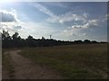
Track on the Waverley Development Site
Image: © Darren Haddock
Taken: 7 Jul 2017
0.13 miles
3
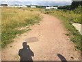
Track on the Waverley Development Site
Looking back towards Orgreave Road / Poplar Way.
Image: © Darren Haddock
Taken: 7 Jul 2017
0.16 miles
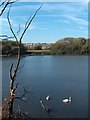
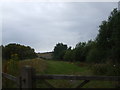
5
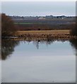
Catcliffe Flash
In the distance across what was an Orgreave opencast mine are new buildings on the Advanced Manufacturing Park.25 years (1984) ago Orgreave was the site of major confrontations with striking coal miners and the police.
Image: © Steve Fareham
Taken: 11 Jan 2009
0.19 miles