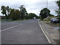
IMAGES TAKEN NEAR TO
Orgreave Road, ROTHERHAM, S60 5TG
Introduction
This page details the photographs taken nearby to Orgreave Road, S60 5TG by members of the Geograph project.
The Geograph project started in 2005 with the aim of publishing, organising and preserving representative images for every square kilometre of Great Britain, Ireland and the Isle of Man.

There are currently over 7.5m images from over14,400 individuals and you can help contribute to the project by visiting https://www.geograph.org.uk
Image Map
Images are licensed for reuse under creativecommons.org/licenses/by-sa/2.0
Notes
- Clicking on the map will re-center to the selected point.
- The higher the marker number, the further away the image location is from the centre of the postcode.
Image Listing (33 Images Found)
Images are licensed for reuse under creativecommons.org/licenses/by-sa/2.0
Image
Details
Distance
2
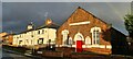
Former Primitive Methodist Chapel, Catcliffe
Image: © Chris Morgan
Taken: 4 Jan 2021
0.08 miles
3
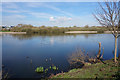
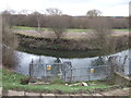
The River Rother
The River Rother between Catcliffe Flash on the right bank and Catcliffe on the left bank. The River Rother has flooded the nearby houses on Orgreave Road on a number of occasions.
Image: © Martin Speck
Taken: 4 Jun 2009
0.11 miles
7
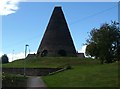
Catcliffe Glass Cone
A well-known landmark at Catcliffe, the Glass Cone, a 70ft brick cone, was built in 1740 by William Fenney. One of the earliest surviving examples of its type and survives partly because it stayed in use until the early 20th century.
http://www.treetonweb.co.uk/parish/catcliffe.htm
Image: © Webmaster
Taken: Unknown
0.14 miles
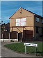
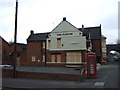
8
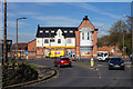
The former Plough Inn
Now Khela's Convenience Stores, Catcliffe.
Image: © Ian S
Taken: 13 Apr 2016
0.14 miles
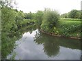
9
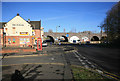
Main Street and The Plough
The Pub is shut along with the railway on the viaduct behind. This once carried the line from Treeton Junction into and out of the old Tinsley yard. The railway has been shut for about twenty years now as for the Pub rather less.
Image: © roger geach
Taken: 18 Nov 2012
0.15 miles