IMAGES TAKEN NEAR TO
Galsworthy Road, SHEFFIELD, S5 8QZ
Introduction
This page details the photographs taken nearby to Galsworthy Road, S5 8QZ by members of the Geograph project.
The Geograph project started in 2005 with the aim of publishing, organising and preserving representative images for every square kilometre of Great Britain, Ireland and the Isle of Man.

There are currently over 7.5m images from over14,400 individuals and you can help contribute to the project by visiting https://www.geograph.org.uk
Image Map
Images are licensed for reuse under creativecommons.org/licenses/by-sa/2.0
Notes
- Clicking on the map will re-center to the selected point.
- The higher the marker number, the further away the image location is from the centre of the postcode.
Image Listing (16 Images Found)
Images are licensed for reuse under creativecommons.org/licenses/by-sa/2.0
Image
Details
Distance
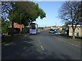
6
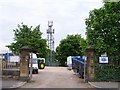
Mast on Moonshine Lane, Longley, Sheffield
Situated (just) within the Moonshine Lane Reservoir site Image
Image: © Terry Robinson
Taken: 19 May 2008
0.18 miles
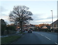
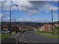
7
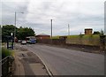
Moonshine Lane
One of the reservoir valve towers can also be seen here on the right of picture.
Image: © Jonathan Clitheroe
Taken: 18 Aug 2015
0.21 miles
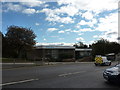
8
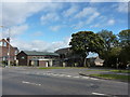
Southey Methodist Church
On Moonshine Lane.
Image: © Peter Barr
Taken: 5 Oct 2011
0.21 miles
10
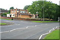
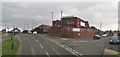
The Five Arches
Named after the nearby railway viaduct (Image) this estate pub on Herris Road is now closed and boarded-up.
Image: © David Lally
Taken: 25 Aug 2008
0.22 miles