IMAGES TAKEN NEAR TO
Windsor Street, SHEFFIELD, S4 7WB
Introduction
This page details the photographs taken nearby to Windsor Street, S4 7WB by members of the Geograph project.
The Geograph project started in 2005 with the aim of publishing, organising and preserving representative images for every square kilometre of Great Britain, Ireland and the Isle of Man.

There are currently over 7.5m images from over14,400 individuals and you can help contribute to the project by visiting https://www.geograph.org.uk
Image Map
Images are licensed for reuse under creativecommons.org/licenses/by-sa/2.0
Notes
- Clicking on the map will re-center to the selected point.
- The higher the marker number, the further away the image location is from the centre of the postcode.
Image Listing (126 Images Found)
Images are licensed for reuse under creativecommons.org/licenses/by-sa/2.0
Image
Details
Distance
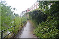
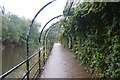
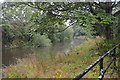
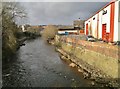
1
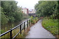
National Cycle Network Route 6 by the River Don
Image: © N Chadwick
Taken: 31 Aug 2015
0.05 miles
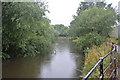
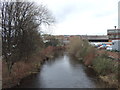
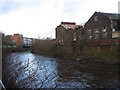
5
River Don from bridge on Attercliffe Road
Image: © Chris Morgan
Taken: 4 Feb 2013
0.07 miles
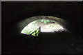
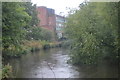
6
Attercliffe - River Don downstream of Washford Bridge
Image: © Dave Bevis
Taken: 16 Dec 2006
0.08 miles