IMAGES TAKEN NEAR TO
St. Marys Rise, CHESTERFIELD, S45 9UA
Introduction
This page details the photographs taken nearby to St. Marys Rise, S45 9UA by members of the Geograph project.
The Geograph project started in 2005 with the aim of publishing, organising and preserving representative images for every square kilometre of Great Britain, Ireland and the Isle of Man.

There are currently over 7.5m images from over14,400 individuals and you can help contribute to the project by visiting https://www.geograph.org.uk
Image Map
Images are licensed for reuse under creativecommons.org/licenses/by-sa/2.0
Notes
- Clicking on the map will re-center to the selected point.
- The higher the marker number, the further away the image location is from the centre of the postcode.
Image Listing (34 Images Found)
Images are licensed for reuse under creativecommons.org/licenses/by-sa/2.0
Image
Details
Distance
1
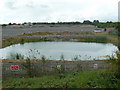
Site of former works
A large industrial site now being cleaned out and levelled for redevelopment.
Image: © Andrew Hill
Taken: 27 May 2011
0.06 miles
2
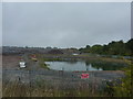
Danger; keep out. Building site
North of Egstow, Clay Cross,the start of a large development, at the town side of which there is already a Tesco (another one).
Image: © Peter Barr
Taken: 8 Sep 2010
0.06 miles
3

Approach to Clay Cross Tunnel north portal
On the Midland Main Line
Image: © Graham Hogg
Taken: 22 Aug 2025
0.06 miles
4
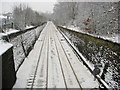
Looking towards Clay Cross Tunnel
View from footbridge to the former Clay Cross Works.
Image
Image: © Alan Heardman
Taken: 5 Feb 2009
0.08 miles
5
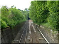
Railway cutting towards Clay Cross tunnel
View from the footbridge over the line. A group of workmen can be seen near the tunnel entrance.
Image: © Andrew Hill
Taken: 27 May 2011
0.09 miles
6
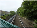
Train about to go under Clay Cross
The line from Chesterfield has split in two half a mile north of here at SK 400 649.This line eventually goes through Ambergate, then to Derby.
Image: © Peter Barr
Taken: 8 Sep 2010
0.10 miles
7
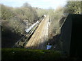
Midland Railway
The Midland railway line as it emerges from Clay Cross tunnel.The picture is taken from between the castellated frontage which can be seen more clearly in Tony Hawes picture Image
Image: © Tony Bacon
Taken: 1 Mar 2008
0.11 miles
8
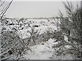
Footpath View of former Clay Cross Works Site
The site is likely to be subject to opencast coal extraction before final development.
Image: © Alan Heardman
Taken: 5 Feb 2009
0.11 miles
9
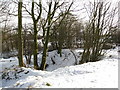
Tupton - Monkey Hollow
One of the hollows but no sign of the monkey.
Image: © Alan Heardman
Taken: 6 Feb 2009
0.14 miles