IMAGES TAKEN NEAR TO
Hallgate Lane, CHESTERFIELD, S45 8HW
Introduction
This page details the photographs taken nearby to Hallgate Lane, S45 8HW by members of the Geograph project.
The Geograph project started in 2005 with the aim of publishing, organising and preserving representative images for every square kilometre of Great Britain, Ireland and the Isle of Man.

There are currently over 7.5m images from over14,400 individuals and you can help contribute to the project by visiting https://www.geograph.org.uk
Image Map
Images are licensed for reuse under creativecommons.org/licenses/by-sa/2.0
Notes
- Clicking on the map will re-center to the selected point.
- The higher the marker number, the further away the image location is from the centre of the postcode.
Image Listing (45 Images Found)
Images are licensed for reuse under creativecommons.org/licenses/by-sa/2.0
Image
Details
Distance
1
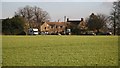
Hallgate Farm
The photograph shows Hallgate Farm, Pilsley.
The campervan is parked near an area that the farm uses as a five pitch Camping and Caravan Club Certified Location, which is normally open from March to October.
In the gap between the buildings behind the campervan is the farm’s exit to Image
Across the middle of the field (notice the slight disturbance in the crop) is a public Image that runs from Image to Padley Wood Road.
Image: © Alan Walker
Taken: 6 Feb 2007
0.04 miles
2
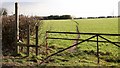
Footpath
The photograph shows the start of a public footpath that leads from Image, over fields belonging to Image, to Image, Pilsley.
Immediately behind the viewpoint is the beginning of a Image that leads to Image, Lower Pilsley.
Approximately 50 metres to the right (westerly) of this viewpoint another Image leads to Danesmoor.
For a more southerly (ahead) photograph taken from beyond the hedge in the distance, click here Image
Image: © Alan Walker
Taken: 6 Feb 2007
0.04 miles
3
View Across Fields Towards Hallgate Lane
Image: © Alan Heardman
Taken: 2 Aug 2007
0.06 miles
4
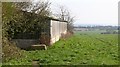
Footpath
The photograph shows a footpath leading toward Image, Pilsley. Ahead others branch off toward Image, Image, Morton and toward the A61 the near Stretton.
Behind the viewpoint the footpath leads toward Image, Pilsley.
The building is a barn belonging to Hallgate Farm.
For a more southerly (ahead) photograph of the footpath, click here Image
For a more northerly (behind the viewpoint) photograph of the footpath, click here Image
Image: © Alan Walker
Taken: 2 Apr 2007
0.06 miles
5
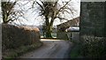
Hallgate Lane
The photograph shows Hallgate Lane at an ‘S-bend’ where it passes behind buildings belonging to Hallgate Farm.
Ahead and to the left there is this Image before the lane continues toward its junction with Image
Behind the viewpoint there is the entrance to Image and, also, the lane continues toward its terminus at Bushypark Farm.
To the right of the tree in the centre of the photograph there is a Image that marks the beginning of a footpath across fields to Image
To see a more easterly (ahead and to the left) photograph of Hallgate Lane, click here Image
To see a more westerly (behind the viewpoint and to the right) photograph of Hallgate Lane, click here Image
Image: © Alan Walker
Taken: 6 Feb 2007
0.07 miles
6
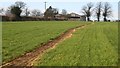
Footpath
The photograph shows a public footpath that runs from Image (behind the viewpoint) to Image (ahead, beyond the trees on the horizon). It was taken from a point where it crosses another footpath that runs from Broom Avenue (to the right) toward the A61 the near Stretton (to the left).
To see the footpath to the right, taken from approximately the same point, click here Image
To see a photograph of this footpath taken from the same viewpoint, but in the opposite direction, click here Image
To see a more northerly (ahead) photograph of the footpath but looking back, toward this viewpoint, click here Image
Image: © Alan Walker
Taken: 1 Feb 2007
0.08 miles
7
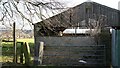
Sloping stone
The sloping stone and the newer pillar next to it form the squeeze-stile that is the entrance to a public Image from Image to Image
The farm building is part of Image
Image: © Alan Walker
Taken: 6 Feb 2007
0.08 miles
8
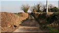
Hallgate Lane
The photograph shows Hallgate Lane looking in an easterly direction toward Hallgate Farm, part of which can just be seen in the trees to the right.
The photograph was taken from a point where, just off the right of the picture, a Image, from Image meets Hallgate Lane.
Also from this point, but off the left of the picture, a Image crosses over fields to Image, Lower Pilsley.
Behind the viewpoint the lane continues toward its terminus at Bushypark Farm.
To see a more easterly (ahead) photograph of Hallgate Lane, click here Image
To see a more south-westerly (some 50 metres behind the viewpoint) photograph of Hallgate Lane, click here Image
Image: © Alan Walker
Taken: 6 Feb 2007
0.08 miles
9
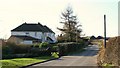
Hallgate Lane
The photograph shows the point where Hallgate Lane narrows to a single-track road.
To see a more westerly (ahead) photograph of Hallgate Lane, click here Image
For a more easterly (behind the viewpoint) photograph of Hallgate Lane, click here Image
Image: © Alan Walker
Taken: 6 Feb 2007
0.09 miles