
IMAGES TAKEN NEAR TO
Station Road, CHESTERFIELD, S45 8EZ
Introduction
This page details the photographs taken nearby to Station Road, S45 8EZ by members of the Geograph project.
The Geograph project started in 2005 with the aim of publishing, organising and preserving representative images for every square kilometre of Great Britain, Ireland and the Isle of Man.

There are currently over 7.5m images from over14,400 individuals and you can help contribute to the project by visiting https://www.geograph.org.uk
Image Map
Images are licensed for reuse under creativecommons.org/licenses/by-sa/2.0
Notes
- Clicking on the map will re-center to the selected point.
- The higher the marker number, the further away the image location is from the centre of the postcode.
Image Listing (142 Images Found)
Images are licensed for reuse under creativecommons.org/licenses/by-sa/2.0
Image
Details
Distance
1
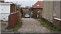
Footpath
The photograph shows the junction of the footpath that runs south from Image to this point on Image For the first few metres the path shares a drive with the house, right of centre, in the middle distance and beyond a gateway to a field.
For a more northerly view of this footpath click here Image
Image: © Alan Walker
Taken: 15 Jan 2007
0.02 miles
2
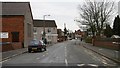
Station Road
Station Road from its junction with Image (behind the viewpoint) and Image to the left of the photograph.
The wall on the right is the boundary wall with Image At the end of this wall is the junction with Image
The wall on the left is the boundary with the Image
The tall building on the left used to be the Wesleyan Methodist church hall and schoolroom but in 1995 the main church building was found to be unsafe. Consequently the church building was demolished and the church hall and schoolroom now act as the church proper. Beyond this building is the junction with Image
For a more north-easterly view (ahead) of Station Road, click here Image
Image: © Alan Walker
Taken: 15 Jan 2007
0.02 miles
3
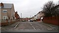
Queen Street
The photograph shows the junction of Queen Street with Image
Over the rise, Image continues northward toward its junction with Brunswick Street.
Image: © Alan Walker
Taken: 15 Jan 2007
0.02 miles
4
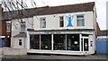
by Paul Harrison
This shop is in Image
The shop front proclaims that it sells items such as designer jewellery, clocks, wands, sculptures, pendants, crystals, furniture.
Click one of these to see other shops in Pilsley:
Image
Image
Image
Image
Image
Image
Image: © Alan Walker
Taken: 15 Jan 2007
0.03 miles
5
Prospect Road
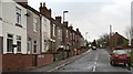
Prospect Road from its junction with Image
The southerly end of the road junctions with Image On the right-hand side of the photograph can be seen part of the Image
To see a view northward from the southern end, click here Image
Image: © Alan Walker
Taken: 11 Jan 2007
0.03 miles
6
Gifts and Tarot Reading Shop in Pilsley
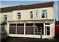
It seemed incongruous from both points of view - fortune telling and gift buying - in the heart of a former pit village. The same shop was spotted by Alan Walker in 2007. See http://www.geograph.org.uk/photo/314097
Image: © Neil Theasby
Taken: 11 Dec 2015
0.04 miles
7
Prospect Road
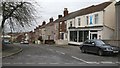
The photograph shows the northward view into Prospect Road from its junction with Image
The shop is 'by Paul Harrison'.
Behind the viewpoint, and slightly to the left, is the junction of Station Road with Image
To see a view of the road southward, from the northern end, click here Image
Image: © Alan Walker
Taken: 15 Jan 2007
0.04 miles
8
Manor Farm
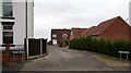
The photograph shows the junction of the cul-de-sac, Manor Farm, with Image
Image: © Alan Walker
Taken: 15 Jan 2007
0.04 miles
9
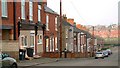
Queen Street
Prior to 1800, Pilsley was purely an agricultural settlement and at that time it consisted of Upper Pilsley and Nether Pilsley. Few of the houses from that period still exist, though those that do are to mostly found around Barlow Bank Image in Upper Pilsley. Today there is a mixture of housing - modern estates, social housing and terraces like these (this one is Queen Street) that were built for the miners who worked in the local (long closed) pit. This view is looking north.
Image: © Alan Walker
Taken: 24 Jan 2006
0.05 miles
10
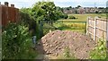
Footpath
The public footpath is to the left of the green gatepost and, on the day the photograph was taken, was partially obstructed by a mound of soil. The field beyond the gate often has horses in it and the housing estate in the distance was built by ‘Barratt Homes’ circa 1979/81.
For a view of the Slack’s Lane end of the footpath, click here Image
For a more northerly view of this footpath back towards this viewpoint, click here Image
For a more southerly view (behind the viewpoint, towards Station Road) of the footpath, click here Image
Image: © Alan Walker
Taken: 23 Jun 2006
0.05 miles