IMAGES TAKEN NEAR TO
Ashover, CHESTERFIELD, S45 0JZ
Introduction
This page details the photographs taken nearby to S45 0JZ by members of the Geograph project.
The Geograph project started in 2005 with the aim of publishing, organising and preserving representative images for every square kilometre of Great Britain, Ireland and the Isle of Man.

There are currently over 7.5m images from over14,400 individuals and you can help contribute to the project by visiting https://www.geograph.org.uk
Image Map
Images are licensed for reuse under creativecommons.org/licenses/by-sa/2.0
Notes
- Clicking on the map will re-center to the selected point.
- The higher the marker number, the further away the image location is from the centre of the postcode.
Image Listing (20 Images Found)
Images are licensed for reuse under creativecommons.org/licenses/by-sa/2.0
Image
Details
Distance
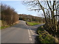
1
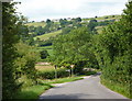
B6014 towards Butterley
The road is more like a country lane than the classification would suggest, with beautiful views and also bends and hills to be negotiated.
Image: © Andrew Hill
Taken: 24 Jul 2010
0.04 miles
2
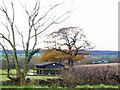
Stable at Ashover Hay
As one travels due south from Milltown, after about a mile Oakstedge Lane meets the B6014 at Ashover Hay. These stables face the end of the lane.
Image: © Roger May
Taken: 5 Dec 2005
0.05 miles
6
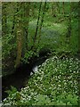
Clattercotes Wood Bluebells and Wild Garlic
Image: © Alan Heardman
Taken: 17 May 2000
0.05 miles
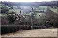
7
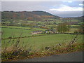
Oakstedge Lane view towards Ravensnest
Image: © Alan Heardman
Taken: 4 Nov 2000
0.05 miles
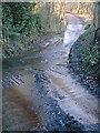
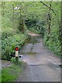
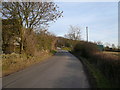
8
Road Junction
Butterley Lane junction with Whitecarr Lane.
Image: © Alan Heardman
Taken: 4 Feb 2007
0.06 miles
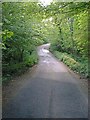
9
Butterley Lane view towards Whitecarr Lane Junction
Image: © Alan Heardman
Taken: 4 Feb 2007
0.07 miles