IMAGES TAKEN NEAR TO
Lickpenny Lane, CHESTERFIELD, S45 0JQ
Introduction
This page details the photographs taken nearby to Lickpenny Lane, S45 0JQ by members of the Geograph project.
The Geograph project started in 2005 with the aim of publishing, organising and preserving representative images for every square kilometre of Great Britain, Ireland and the Isle of Man.

There are currently over 7.5m images from over14,400 individuals and you can help contribute to the project by visiting https://www.geograph.org.uk
Image Map
Images are licensed for reuse under creativecommons.org/licenses/by-sa/2.0
Notes
- Clicking on the map will re-center to the selected point.
- The higher the marker number, the further away the image location is from the centre of the postcode.
Image Listing (8 Images Found)
Images are licensed for reuse under creativecommons.org/licenses/by-sa/2.0
Image
Details
Distance
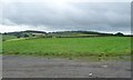
1
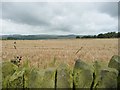
Barley field, south of Poorlots Quarry
Looking westwards.
Image: © Christine Johnstone
Taken: 2 Sep 2016
0.04 miles
2
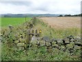
Public footpath to Knabhall Lane
Running west from an anonymous lane, along the south side of a barley field.
Image: © Christine Johnstone
Taken: 2 Sep 2016
0.05 miles
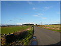
3
Holestone Gate Road
Looking in the direction of Red House Farm.
Image: © Alan Heardman
Taken: 30 Sep 2007
0.06 miles
4
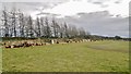
Cones off!
Looks like there's been parking for some sort of event held here and cones have been removed to the sides.
Image: © Chris Morgan
Taken: 23 Mar 2015
0.07 miles
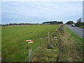
5
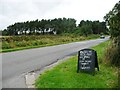
Shelter belt, south side, Poorlots Quarry
The sign in the foreground advertises a farm shop and a cafe.
Image: © Christine Johnstone
Taken: 2 Sep 2016
0.07 miles
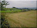
6
Ridge of farmland, west of Butterley
Climbing up to 285 metres above sea level.
Image: © Christine Johnstone
Taken: 2 Sep 2016
0.07 miles
7
View towards Blakelow Hill
The field on the left is the location of the Tansley car boot sale.
Image: © Alan Heardman
Taken: 7 Dec 2007
0.11 miles
8
Blakelow Hill - Distinctive Tree Line
Image: © Alan Heardman
Taken: 26 Sep 2000
0.23 miles