
IMAGES TAKEN NEAR TO
Pear Tree Fold, CHESTERFIELD, S45 0DJ
Introduction
This page details the photographs taken nearby to Pear Tree Fold, S45 0DJ by members of the Geograph project.
The Geograph project started in 2005 with the aim of publishing, organising and preserving representative images for every square kilometre of Great Britain, Ireland and the Isle of Man.

There are currently over 7.5m images from over14,400 individuals and you can help contribute to the project by visiting https://www.geograph.org.uk
Image Map
Images are licensed for reuse under creativecommons.org/licenses/by-sa/2.0
Notes
- Clicking on the map will re-center to the selected point.
- The higher the marker number, the further away the image location is from the centre of the postcode.
Image Listing (93 Images Found)
Images are licensed for reuse under creativecommons.org/licenses/by-sa/2.0
Image
Details
Distance
1
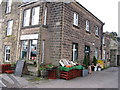
Local Shop
Local shop in Ashover, Derbyshire.
Image: © Dave Pickersgill
Taken: 22 Nov 2008
0.04 miles
5
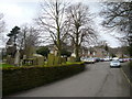
Ashover - Church Street view towards The Crispin Inn
Image: © Alan Heardman
Taken: 18 Feb 2007
0.08 miles
6
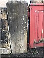
Bench Mark
Bench Mark seen at the entrance to School House Narrowleys Lane Ashover
Image: © Andrew Hardwick
Taken: 25 Jan 2021
0.08 miles
8
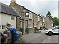
The Crispin inn.
Quiet village of Ashover.
Image: © steven ruffles
Taken: 12 Jun 2018
0.09 miles
9
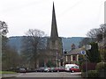
Ashover Parish Church
Ashover Parish Church and the Crispin Inn to the right
Image: © Tony Hawes
Taken: 20 Apr 2007
0.10 miles
10
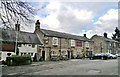
The Crispin Inn, Ashover
Now a Marston's pub, it has a history that their website hardly mentions. Crispin may come from the battle on St Crispin's Day in 1415 when local men returned victorious from Agincourt. From Wikipedia there's more history, as follows.
"Ashover was the scene of a confrontation between the Royalists and the Roundheads during the English Civil War in the 17th century. The Roundheads, short of ammunition, demolished the windows of the church and used the lead to make bullets. They also reduced nearby Eastwood Hall to ruins; all that can be seen today are the ivy-clad remains. Royalists slaughtered livestock and drank all the wine and ale in the cellars of Eddlestow Hall while the owner Sir John Pershall was away. Job Wall, the landlord of the Crispin Inn public house, refused entry to the army, telling them they had had too much to drink. But they threw him out and drank the ale, pouring what was left down the street. Outside, affixed to the front wall of the pub is a signboard with a history of the inn."
Image: © Chris Morgan
Taken: 4 Feb 2014
0.10 miles