IMAGES TAKEN NEAR TO
Cullumbell Lane, Uppertown, CHESTERFIELD, S45 0DG
Introduction
This page details the photographs taken nearby to Cullumbell Lane, Uppertown, S45 0DG by members of the Geograph project.
The Geograph project started in 2005 with the aim of publishing, organising and preserving representative images for every square kilometre of Great Britain, Ireland and the Isle of Man.

There are currently over 7.5m images from over14,400 individuals and you can help contribute to the project by visiting https://www.geograph.org.uk
Image Map
Images are licensed for reuse under creativecommons.org/licenses/by-sa/2.0
Notes
- Clicking on the map will re-center to the selected point.
- The higher the marker number, the further away the image location is from the centre of the postcode.
Image Listing (11 Images Found)
Images are licensed for reuse under creativecommons.org/licenses/by-sa/2.0
Image
Details
Distance
1
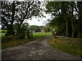
Cullumbell Lane View of Farm at Bunting Field
Image: © Alan Heardman
Taken: 30 Sep 2007
0.03 miles

3
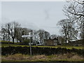
Buntingfield, a farmhouse
At the junction of Buntingfield Lane and Cullumbell Lane, near Uppertown
Image: © Peter Barr
Taken: 28 Feb 2010
0.07 miles
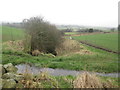
4
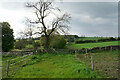
Footpath near Bunting Field Farm
Heading towards Peasunhurst, and currently passing through paddocks.
Image: © Bill Boaden
Taken: 28 May 2021
0.09 miles
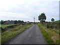
5
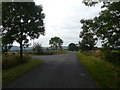
Buntingfield Lane Junction with Cullumbell Lane
Image: © Alan Heardman
Taken: 30 Sep 2007
0.10 miles
6
Buntingfield Lane with view to Dryhurst Farm
Image: © Neil Theasby
Taken: 14 Nov 2013
0.11 miles
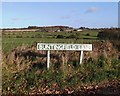
7
Uppertown
Entering Uppertown on Cullumbell Lane.
Image: © Alan Heardman
Taken: 30 Sep 2007
0.18 miles
8
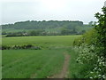
Path to Peasunhurst
The path crosses fields from Uppertown.
Image: © Andrew Hill
Taken: 2 Jun 2012
0.22 miles
10
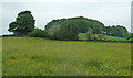
Meadow near Uppertown
The hamlet is surrounded by colourful meadows at this time of year.
Image: © Andrew Hill
Taken: 2 Jun 2012
0.24 miles