
IMAGES TAKEN NEAR TO
Church Street, CHESTERFIELD, S45 0AB
Introduction
This page details the photographs taken nearby to Church Street, S45 0AB by members of the Geograph project.
The Geograph project started in 2005 with the aim of publishing, organising and preserving representative images for every square kilometre of Great Britain, Ireland and the Isle of Man.

There are currently over 7.5m images from over14,400 individuals and you can help contribute to the project by visiting https://www.geograph.org.uk
Image Map
Images are licensed for reuse under creativecommons.org/licenses/by-sa/2.0
Notes
- Clicking on the map will re-center to the selected point.
- The higher the marker number, the further away the image location is from the centre of the postcode.
Image Listing (96 Images Found)
Images are licensed for reuse under creativecommons.org/licenses/by-sa/2.0
Image
Details
Distance
1
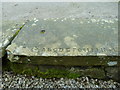
Practice Stone
Slab of stone with carved letters situated in front of the Church Hall Image According to the Ashover Audio Trail, http://www.hidden-gems.org.uk/hidden-gems/ashover-trail it is where the apprentice masons would practice before going on to the proper headstones.
Image: © Tony Bacon
Taken: 22 Jul 2012
0.00 miles
2
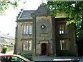
Church Hall
Church hall, known locally as The Bassett Rooms for its connection with the famous confectionery manufacturers. It was originally built as a girls school. More information can be found here:- http://www.hidden-gems.org.uk/hidden-gems/ashover-trail
Image: © Tony Bacon
Taken: 22 Jul 2012
0.00 miles
3
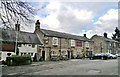
The Crispin Inn, Ashover
Now a Marston's pub, it has a history that their website hardly mentions. Crispin may come from the battle on St Crispin's Day in 1415 when local men returned victorious from Agincourt. From Wikipedia there's more history, as follows.
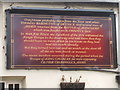
"Ashover was the scene of a confrontation between the Royalists and the Roundheads during the English Civil War in the 17th century. The Roundheads, short of ammunition, demolished the windows of the church and used the lead to make bullets. They also reduced nearby Eastwood Hall to ruins; all that can be seen today are the ivy-clad remains. Royalists slaughtered livestock and drank all the wine and ale in the cellars of Eddlestow Hall while the owner Sir John Pershall was away. Job Wall, the landlord of the Crispin Inn public house, refused entry to the army, telling them they had had too much to drink. But they threw him out and drank the ale, pouring what was left down the street. Outside, affixed to the front wall of the pub is a signboard with a history of the inn."
Image: © Chris Morgan
Taken: 4 Feb 2014
0.02 miles
4
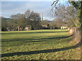
Ashover village from the south-east
Taken from public footpath from Ashover to Fall Hill and Fallgate. Lovely light on a very mild day in late December.
Image: © Lesley Eddleston
Taken: 27 Dec 2011
0.02 miles
5
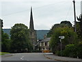
Church, Pub and skip
The pub is The Crispin.
Image: © Peter Barr
Taken: 28 Jul 2010
0.02 miles
7
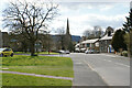
Church Street, Ashover
The main street through the village.
Image: © Bill Boaden
Taken: 15 Apr 2021
0.03 miles
8
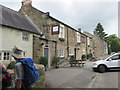
The Crispin inn.
Quiet village of Ashover.
Image: © steven ruffles
Taken: 12 Jun 2018
0.03 miles
9
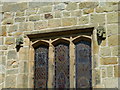
Carved Heads
Two carved heads beside a window in Ashover Parish Church. According to Ashover Audio Trails, http://www.hidden-gems.org.uk/hidden-gems/ashover-trail the heads are of fellow masons, presumably to better their skills.
Image: © Tony Bacon
Taken: 22 Jul 2012
0.03 miles
10
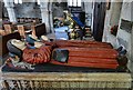
Ashover: All Saints Church: The Babington tomb 1
Image: © Michael Garlick
Taken: 1 May 2016
0.03 miles