IMAGES TAKEN NEAR TO
Follows Way, S44 6ZJ
Introduction
This page details the photographs taken nearby to Follows Way, S44 6ZJ by members of the Geograph project.
The Geograph project started in 2005 with the aim of publishing, organising and preserving representative images for every square kilometre of Great Britain, Ireland and the Isle of Man.

There are currently over 7.5m images from over14,400 individuals and you can help contribute to the project by visiting https://www.geograph.org.uk
Image Map (Loading...)


Getting Data...Please wait
Leaflet Map data © OpenStreetMap
Images are licensed for reuse under creativecommons.org/licenses/by-sa/2.0
Notes
- Clicking on the map will re-center to the selected point.
- The higher the marker number, the further away the image location is from the centre of the postcode.
Image Listing (13 Images Found)
Images are licensed for reuse under creativecommons.org/licenses/by-sa/2.0
Image
Details
Distance
1
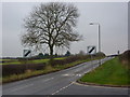
Marlpit Lane leaving Bolsover
Looking across the turn for the hospital in the foreground.
Image: © Andrew Hill
Taken: 18 Nov 2010
0.07 miles
2
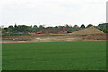
Excavators at work on Destination 14
Part of a large northwards expansion of Bolsover.
Image: © Bill Boaden
Taken: 8 May 2022
0.08 miles
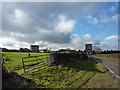
4
Bolsover Community Hospital - Viewed from Elmton Lane
Image: © Alan Heardman
Taken: 5 Oct 2008
0.12 miles
5
Bolsover Hospital
Soon to be demolished to make way for 70 houses
Image: © John Slater
Taken: 29 May 2019
0.12 miles
6
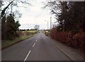
Marlpit Lane in Bolsover
Heading out of the town towards Bolsover Moor.
Image: © Jonathan Clitheroe
Taken: 17 Mar 2012
0.13 miles
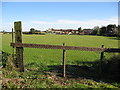
8
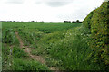
Another field earmarked for housing
There is major current and future housing expansion to the north of Bolsover, which will include this field. Elmton Lane will be retained as a green wildlife corridor.
Image: © Bill Boaden
Taken: 8 May 2022
0.20 miles
9
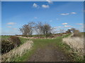
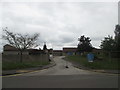
Junction of two lanes
Elmton Lane to the left and Oxcroft Lane to the right.
Image: © Neil Theasby
Taken: 24 Mar 2014
0.20 miles
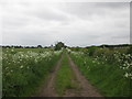
10
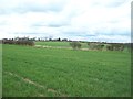
Arable Land near Elmton Lane
This area is named after a limekiln that used to operate nearby.
Image: © Jonathan Clitheroe
Taken: 17 Mar 2012
0.20 miles