IMAGES TAKEN NEAR TO
Ridgeway Avenue, CHESTERFIELD, S44 6XQ
Introduction
This page details the photographs taken nearby to Ridgeway Avenue, S44 6XQ by members of the Geograph project.
The Geograph project started in 2005 with the aim of publishing, organising and preserving representative images for every square kilometre of Great Britain, Ireland and the Isle of Man.

There are currently over 7.5m images from over14,400 individuals and you can help contribute to the project by visiting https://www.geograph.org.uk
Image Map
Images are licensed for reuse under creativecommons.org/licenses/by-sa/2.0
Notes
- Clicking on the map will re-center to the selected point.
- The higher the marker number, the further away the image location is from the centre of the postcode.
Image Listing (14 Images Found)
Images are licensed for reuse under creativecommons.org/licenses/by-sa/2.0
Image
Details
Distance
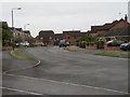
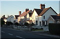
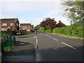
2
Bolsover - Sandhills Road
A residential road with the spire of Bolsover Parish Church, the church of St. Mary and St. Laurence, in the distance.
Image: © Gordon Elliott
Taken: 19 May 2009
0.09 miles
3
Bolsover - Horsehead Lane
A comparatively recent residential development in the town of Bolsover.
Image: © Gordon Elliott
Taken: 19 May 2009
0.14 miles
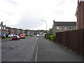
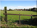
4
Welbeck Road, Bolsover
One side of the street is lined with traditional terraced houses.
Image: © Andrew Hill
Taken: 18 Nov 2010
0.16 miles
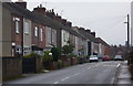
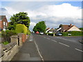
5
Houses on Moor Lane, Bolsover
Traditional housing in a residential area of Bolsover.
Image: © Andrew Hill
Taken: 20 Jan 2011
0.16 miles
6
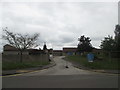
Bolsover Hospital
Soon to be demolished to make way for 70 houses
Image: © John Slater
Taken: 29 May 2019
0.19 miles
7
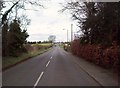
Marlpit Lane in Bolsover
Heading out of the town towards Bolsover Moor.
Image: © Jonathan Clitheroe
Taken: 17 Mar 2012
0.20 miles
8
Bolsover Community Hospital - Viewed from Elmton Lane
Image: © Alan Heardman
Taken: 5 Oct 2008
0.20 miles
9
Bolsover - Horsehead Lane
Originally an un-metalled farm track, this is now the eastern end of a substantial residential road.
Image: © Gordon Elliott
Taken: 19 May 2009
0.22 miles
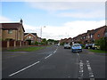
10
Bolsover - Moor Lane
A tree lined residential road leading to The Bolsover School, just around the corner at the far end.
Image: © Gordon Elliott
Taken: 19 May 2009
0.22 miles