IMAGES TAKEN NEAR TO
Harewood Close, S44 6WP
Introduction
This page details the photographs taken nearby to Harewood Close, S44 6WP by members of the Geograph project.
The Geograph project started in 2005 with the aim of publishing, organising and preserving representative images for every square kilometre of Great Britain, Ireland and the Isle of Man.

There are currently over 7.5m images from over14,400 individuals and you can help contribute to the project by visiting https://www.geograph.org.uk
Image Map
Images are licensed for reuse under creativecommons.org/licenses/by-sa/2.0
Notes
- Clicking on the map will re-center to the selected point.
- The higher the marker number, the further away the image location is from the centre of the postcode.
Image Listing (11 Images Found)
Images are licensed for reuse under creativecommons.org/licenses/by-sa/2.0
Image
Details
Distance
1
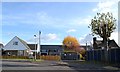
Moor Lane entrance to Bolsover School
This is the town's recently redeveloped secondary school.
Image: © Neil Theasby
Taken: 11 Nov 2012
0.04 miles
2
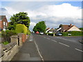
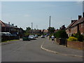
Bolsover - Moor Lane
A tree lined residential road leading to The Bolsover School, just around the corner at the far end.
Image: © Gordon Elliott
Taken: 19 May 2009
0.07 miles
3
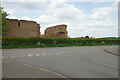
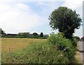
Haystacks by Mooracre Lane
These are directly opposite the entrance to Bolsover School. Some of these stacks have been here a while, with the smaller one having a healthy growth of grass on top of it.
Image: © Bill Boaden
Taken: 8 May 2022
0.15 miles
5
Moorfield Avenue, Bolsover
Hot June day, blokes in shorts, workmen doing not much, stretch limo' awaiting celebrity passengers.
Image: © Peter Barr
Taken: 26 Jun 2010
0.16 miles
6
The Bolsover School
Looking towards The Bolsover School on the outer edge of Bolsover town.
Image: © Philip Thompson
Taken: 13 Jul 2005
0.16 miles
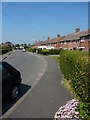
7
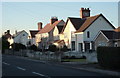
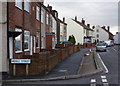
Houses on Moor Lane, Bolsover
Traditional housing in a residential area of Bolsover.
Image: © Andrew Hill
Taken: 20 Jan 2011
0.18 miles
8
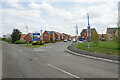
Entrance to Hedgerows
A new green field housing site on the edge of Bolsover.
Image: © Bill Boaden
Taken: 8 May 2022
0.21 miles
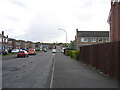
9
Houses on Langwith Road
Hillstown at the southeastern corner of Bolsover is the highest part of the town.
Image: © Andrew Hill
Taken: 8 Jan 2011
0.21 miles
10
Bolsover - Sandhills Road
A residential road with the spire of Bolsover Parish Church, the church of St. Mary and St. Laurence, in the distance.
Image: © Gordon Elliott
Taken: 19 May 2009
0.23 miles