IMAGES TAKEN NEAR TO
Oxcroft View, CHESTERFIELD, S44 6AA
Introduction
This page details the photographs taken nearby to Oxcroft View, S44 6AA by members of the Geograph project.
The Geograph project started in 2005 with the aim of publishing, organising and preserving representative images for every square kilometre of Great Britain, Ireland and the Isle of Man.

There are currently over 7.5m images from over14,400 individuals and you can help contribute to the project by visiting https://www.geograph.org.uk
Image Map
Images are licensed for reuse under creativecommons.org/licenses/by-sa/2.0
Notes
- Clicking on the map will re-center to the selected point.
- The higher the marker number, the further away the image location is from the centre of the postcode.
Image Listing (29 Images Found)
Images are licensed for reuse under creativecommons.org/licenses/by-sa/2.0
Image
Details
Distance
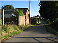
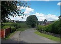
3
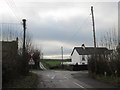
Stanfree - Church Road
Blackbanks junction with Church Road.
Image: © Alan Heardman
Taken: 3 Jul 2008
0.08 miles
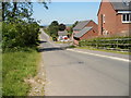
4
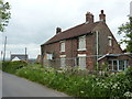
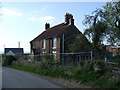
Old house, boarded up, for sale
On Oxcroft Lane, in the village of Stanfree.
Image: © Peter Barr
Taken: 29 May 2012
0.09 miles
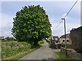
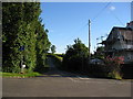
5
Cottages in Stanfree
On a minor road to the east of the village
Image: © Graham Hogg
Taken: 7 May 2019
0.09 miles
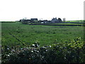
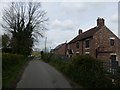
7
Church Road in Stanfree
Calow Farm is partially visible on the right of picture.
Image: © Jonathan Clitheroe
Taken: 9 Aug 2014
0.12 miles