IMAGES TAKEN NEAR TO
Old Works Lane, CHESTERFIELD, S44 5UL
Introduction
This page details the photographs taken nearby to Old Works Lane, S44 5UL by members of the Geograph project.
The Geograph project started in 2005 with the aim of publishing, organising and preserving representative images for every square kilometre of Great Britain, Ireland and the Isle of Man.

There are currently over 7.5m images from over14,400 individuals and you can help contribute to the project by visiting https://www.geograph.org.uk
Image Map
Images are licensed for reuse under creativecommons.org/licenses/by-sa/2.0
Notes
- Clicking on the map will re-center to the selected point.
- The higher the marker number, the further away the image location is from the centre of the postcode.
Image Listing (5 Images Found)
Images are licensed for reuse under creativecommons.org/licenses/by-sa/2.0
Image
Details
Distance
1
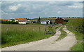
Farm track near Moor Farm
The easternmost of three tracks that head north off the track from the main A632.
Image: © Andrew Hill
Taken: 20 Jun 2011
0.04 miles
2
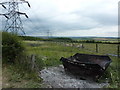
Burnt out skip, cattle and pylons
Looking east from Moor Farm, Calow, towards Arkwright Town.
Image: © Peter Barr
Taken: 7 Jul 2010
0.10 miles
3
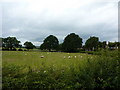
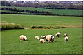
Sheep grazing near Moor Farm
Between Calow and Arkwright Farm, near Chesterfield.
Image: © Peter Barr
Taken: 7 Jul 2010
0.12 miles
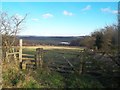
5
Curious sheep
On grassland near Calow (the settlement at the back of the picture)
Image: © Graham Hogg
Taken: 28 Apr 2014
0.25 miles