IMAGES TAKEN NEAR TO
Mansfield Road, CHESTERFIELD, S44 5SG
Introduction
This page details the photographs taken nearby to Mansfield Road, S44 5SG by members of the Geograph project.
The Geograph project started in 2005 with the aim of publishing, organising and preserving representative images for every square kilometre of Great Britain, Ireland and the Isle of Man.

There are currently over 7.5m images from over14,400 individuals and you can help contribute to the project by visiting https://www.geograph.org.uk
Image Map
Images are licensed for reuse under creativecommons.org/licenses/by-sa/2.0
Notes
- Clicking on the map will re-center to the selected point.
- The higher the marker number, the further away the image location is from the centre of the postcode.
Image Listing (13 Images Found)
Images are licensed for reuse under creativecommons.org/licenses/by-sa/2.0
Image
Details
Distance
1
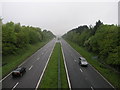
Shortened Horizon
The low cloud and rain have shortened the view to the horizon on this west looking view of the A617.
Image: © Michael Patterson
Taken: 26 May 2006
0.03 miles
2
North East Derbyshire : The A617
Looking along the A617 in North East Derbyshire.
Image: © Lewis Clarke
Taken: 30 Sep 2018
0.04 miles
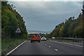
3
Yet more spray on the A617
On our way to our hotel prior to going to the RHS Chatsworth Flower Show. The road spray and rain were quite heavy and we were hoping for better weather on the first day of the show.
Image: © Malcolm Neal
Taken: 4 Jun 2019
0.07 miles
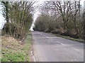
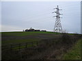
6
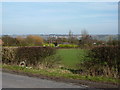
Mansfield Road, from Slack Lane
Bolsover and castle on the horizon.
Image: © Peter Barr
Taken: 24 Feb 2011
0.12 miles
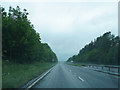
7
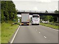
Eastbound A617, Shire Lane bridge
The A617 is dual carriageway between Chesterfield and the M1 motorway.
Image: © David Dixon
Taken: 4 Aug 2014
0.12 miles
8
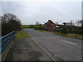
Shire Lane view towards Junction with Mansfield Road
Picture taken from Hasland Bypass (A617) flyover.
Image: © Alan Heardman
Taken: 20 Feb 2007
0.13 miles
10
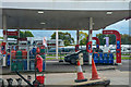
North East Derbyshire : Esso Petrol Station
At one of the parking spots by the Esso.
Image: © Lewis Clarke
Taken: 3 Oct 2018
0.22 miles