IMAGES TAKEN NEAR TO
Dunsil Close, CHESTERFIELD, S44 5FF
Introduction
This page details the photographs taken nearby to Dunsil Close, S44 5FF by members of the Geograph project.
The Geograph project started in 2005 with the aim of publishing, organising and preserving representative images for every square kilometre of Great Britain, Ireland and the Isle of Man.

There are currently over 7.5m images from over14,400 individuals and you can help contribute to the project by visiting https://www.geograph.org.uk
Image Map
Images are licensed for reuse under creativecommons.org/licenses/by-sa/2.0
Notes
- Clicking on the map will re-center to the selected point.
- The higher the marker number, the further away the image location is from the centre of the postcode.
Image Listing (16 Images Found)
Images are licensed for reuse under creativecommons.org/licenses/by-sa/2.0
Image
Details
Distance
2
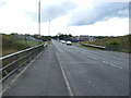
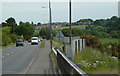
The A632 near Arkwright Town
The view was snapped on the former course of an old railway track - once connected with coal mining.
Image: © Neil Theasby
Taken: 21 Mar 2014
0.04 miles
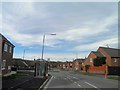
4
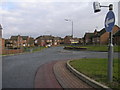
Rosling Way in Arkwright Town
Residential street, close to the A632 road which separates the new village from the site of the original settlement.
Image: © Jonathan Clitheroe
Taken: 1 Dec 2012
0.09 miles
5
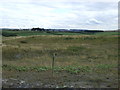
Chesterfield Road east of Arkwright Town
The A632 towards Bolsover.
Image: © Andrew Hill
Taken: 6 Jun 2011
0.11 miles
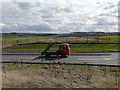
7
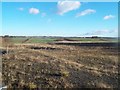
Site of Former Opencast Workings near Arkwright
Seen here from the A632 road this area would previously have been near the eastern fringe of the old Arkwright village and colliery.
Image: © Jonathan Clitheroe
Taken: 1 Dec 2012
0.11 miles
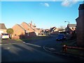
8
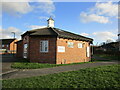
New Arkwright Town
This modern village was created to replace the old village which was located to the south of the A632 when the old village, which consisted of rows of terraced houses, was demolished to remove the risk of methane gas from old mine workings. See Image
Image: © Michael Patterson
Taken: 21 Feb 2006
0.13 miles
10
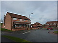
Post Office and General stores, Arkwright Town
And takeaway.
Arkwright Town, commonly referred to as Arkwright, is a settlement in North East Derbyshire, England that is notable for having moved its location in the early 1990s. Despite its name, the settlement has no official town status.
Located between Chesterfield and Bolsover on the A632 road it was formerly a coal mining village. Arkwright Colliery closed in 1988 and it was then discovered that the community was threatened by emissions of methane gas that caused some of its houses to be evacuated. The whole settlement was owned by British Coal and a decision was taken, along with Derbyshire County Council, to transfer ownership of the 52 properties to a housing trust, construct a new settlement of 56 properties to the north of the site affected by methane, and move all the residents. Construction was completed by 1995 when the old Arkwright Town was demolished. (notes from Wikipedia)
Image: © Peter Barr
Taken: 24 Feb 2011
0.18 miles