IMAGES TAKEN NEAR TO
Slaley Lane, CHESTERFIELD, S43 4UA
Introduction
This page details the photographs taken nearby to Slaley Lane, S43 4UA by members of the Geograph project.
The Geograph project started in 2005 with the aim of publishing, organising and preserving representative images for every square kilometre of Great Britain, Ireland and the Isle of Man.

There are currently over 7.5m images from over14,400 individuals and you can help contribute to the project by visiting https://www.geograph.org.uk
Image Map
Images are licensed for reuse under creativecommons.org/licenses/by-sa/2.0
Notes
- Clicking on the map will re-center to the selected point.
- The higher the marker number, the further away the image location is from the centre of the postcode.
Image Listing (13 Images Found)
Images are licensed for reuse under creativecommons.org/licenses/by-sa/2.0
Image
Details
Distance
1
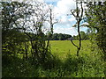
Hoodcroft, a farm near Barlborough
Farmland, Clowne Common.
Image: © Peter Barr
Taken: 28 Jul 2012
0.01 miles
4
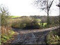
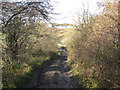
Junction of Slayley Lane and Hoodcroft Lane
Image: © Alan Heardman
Taken: 18 Nov 2008
0.15 miles
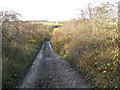
5
Slayley Lane - Approaching the Stream
Image: © Alan Heardman
Taken: 18 Nov 2008
0.16 miles
6
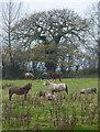
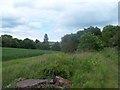
Field with horses by Slayley Lane
A glimpse from the hedge lined track.
Image: © Andrew Hill
Taken: 18 Nov 2010
0.18 miles
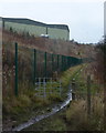
7
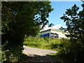
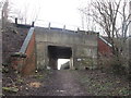
On a track behind Tesco Distribution Centre
Image: © Peter Barr
Taken: 28 Jul 2012
0.18 miles
8
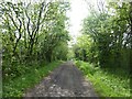
Slaley Hill
A concessionary footpath between Barlborough Common and Clowne. A sign at the western end states the track is unsuitable for motor traffic but that didn't deter the local postman who drove past us!
Image: © Graham Hogg
Taken: 7 May 2019
0.19 miles
10
Footpath below Tesco distribution centre
Seen from Slayley Lane, which is a muddy track unsuitable for vehicles.
Image: © Andrew Hill
Taken: 18 Nov 2010
0.21 miles