IMAGES TAKEN NEAR TO
High Street, CHESTERFIELD, S43 4EY
Introduction
This page details the photographs taken nearby to High Street, S43 4EY by members of the Geograph project.
The Geograph project started in 2005 with the aim of publishing, organising and preserving representative images for every square kilometre of Great Britain, Ireland and the Isle of Man.

There are currently over 7.5m images from over14,400 individuals and you can help contribute to the project by visiting https://www.geograph.org.uk
Image Map
Images are licensed for reuse under creativecommons.org/licenses/by-sa/2.0
Notes
- Clicking on the map will re-center to the selected point.
- The higher the marker number, the further away the image location is from the centre of the postcode.
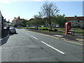
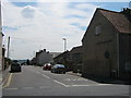
Image Listing (65 Images Found)
Images are licensed for reuse under creativecommons.org/licenses/by-sa/2.0
Image
Details
Distance
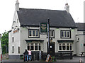
1
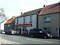
Barlborough Post Office and Convenience Store
On High Street.
Image: © JThomas
Taken: 28 Aug 2014
0.01 miles
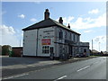
3
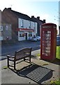
Bench, phone box and shop in Barlborough
The convenience store is also the community's post office, opposite the village green.
Image: © Neil Theasby
Taken: 17 Oct 2012
0.01 miles
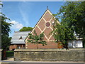
10
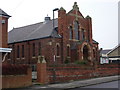
Barlborough Methodist Church
A red brick chapel on New Road.
Image: © Andrew Hill
Taken: 18 Nov 2010
0.04 miles