
IMAGES TAKEN NEAR TO
Clowne Road, CHESTERFIELD, S43 4EJ
Introduction
This page details the photographs taken nearby to Clowne Road, S43 4EJ by members of the Geograph project.
The Geograph project started in 2005 with the aim of publishing, organising and preserving representative images for every square kilometre of Great Britain, Ireland and the Isle of Man.

There are currently over 7.5m images from over14,400 individuals and you can help contribute to the project by visiting https://www.geograph.org.uk
Image Map
Images are licensed for reuse under creativecommons.org/licenses/by-sa/2.0
Notes
- Clicking on the map will re-center to the selected point.
- The higher the marker number, the further away the image location is from the centre of the postcode.
Image Listing (20 Images Found)
Images are licensed for reuse under creativecommons.org/licenses/by-sa/2.0
Image
Details
Distance
1
Bus shelter on Clowne Road
This was to have been the finish of this day's geograph walk but a 30 minute wait for the next bus persuaded me to seek refreshment at a nearby hostelry!
Image: © Graham Hogg
Taken: 28 Feb 2012
0.01 miles
2
Houses and bus stop, Clowne Road, Barlborough
Houses on the south side of the road, looking towards the village centre.
Image: © Andrew Hill
Taken: 26 May 2011
0.04 miles
3
Houses on Clowne Road, Barlborough
Traditional semi-detached houses in the village which has expanded over the years.
Image: © Andrew Hill
Taken: 18 Nov 2010
0.07 miles
4
Clowne Road, Barlborough
Heading north west.
Image: © JThomas
Taken: 28 Aug 2014
0.10 miles
5
Entering Barlborough
Heading north west on Clowne Road.
Image: © JThomas
Taken: 28 Aug 2014
0.10 miles
6
Sycamore Lane
British Gas van waiting; public footpath starts.
Image: © Peter Barr
Taken: 28 Jul 2012
0.13 miles
7
A619 towards Worksop
Heading east from Barlborough.
Speetley Farm on the left.
Image: © JThomas
Taken: 28 Aug 2014
0.21 miles
8
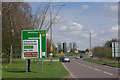
A619 east of Barlborough
Looking along the A619 Chesterfield - Worksop road from close to the De Rodes Arms. Traffic heading for the A618 towards Rotherham is directed to use an unclassified road for a mile or so.
Image: © Stephen McKay
Taken: 11 Apr 2010
0.22 miles
9
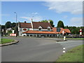
De Rodes Arms, Barlborough
A Crown Carvery.
Image: © JThomas
Taken: 28 Aug 2014
0.22 miles
10
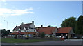
De Rodes Arms, Barlborough
A Crown Carvery on the A619.
Image: © JThomas
Taken: 28 Aug 2014
0.22 miles