IMAGES TAKEN NEAR TO
Boundary Close, CHESTERFIELD, S43 3UD
Introduction
This page details the photographs taken nearby to Boundary Close, S43 3UD by members of the Geograph project.
The Geograph project started in 2005 with the aim of publishing, organising and preserving representative images for every square kilometre of Great Britain, Ireland and the Isle of Man.

There are currently over 7.5m images from over14,400 individuals and you can help contribute to the project by visiting https://www.geograph.org.uk
Image Map
Images are licensed for reuse under creativecommons.org/licenses/by-sa/2.0
Notes
- Clicking on the map will re-center to the selected point.
- The higher the marker number, the further away the image location is from the centre of the postcode.
Image Listing (11 Images Found)
Images are licensed for reuse under creativecommons.org/licenses/by-sa/2.0
Image
Details
Distance
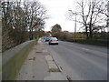
1
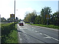
Entering Staveley
Heading west on the A619.
Image: © JThomas
Taken: 18 Apr 2014
0.03 miles
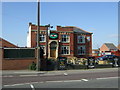
2
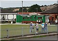
Staveley Welfare Sports Club at Lowgates
Image: © Neil Theasby
Taken: 28 Sep 2014
0.04 miles
6
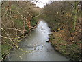
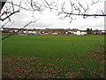
Netherthorpe - River Doe Lea
View from the A619 road bridge.
Image: © Alan Heardman
Taken: 16 Nov 2008
0.17 miles
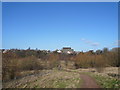
8
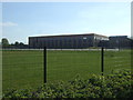
Netherthorpe School - Viewed from Country Park Footpath
Image: © Alan Heardman
Taken: 6 Feb 2008
0.20 miles
9
Worksop Road (A619) - Bridge over the River Doe Lea
Image: © Alan Heardman
Taken: 16 Nov 2008
0.20 miles
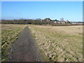
10
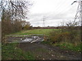
Pylons crossing fields next to the River Doe Lea
Image: © Alan Heardman
Taken: 16 Nov 2008
0.21 miles