IMAGES TAKEN NEAR TO
Madin Drive, CHESTERFIELD, S43 3HH
Introduction
This page details the photographs taken nearby to Madin Drive, S43 3HH by members of the Geograph project.
The Geograph project started in 2005 with the aim of publishing, organising and preserving representative images for every square kilometre of Great Britain, Ireland and the Isle of Man.

There are currently over 7.5m images from over14,400 individuals and you can help contribute to the project by visiting https://www.geograph.org.uk
Image Map
Images are licensed for reuse under creativecommons.org/licenses/by-sa/2.0
Notes
- Clicking on the map will re-center to the selected point.
- The higher the marker number, the further away the image location is from the centre of the postcode.
Image Listing (23 Images Found)
Images are licensed for reuse under creativecommons.org/licenses/by-sa/2.0
Image
Details
Distance
1
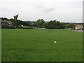
Why Inkersall Green
I can only guess that Inkersall Green gets its name from the fact it is so green? The large building nestled in the trees in the distance is Ringwood Hall in the next square north.
Image: © Michael Patterson
Taken: 13 Sep 2006
0.04 miles
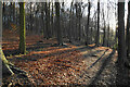
2
Brimington : West Wood
Looking across West Wood in Brimington.
Image: © Lewis Clarke
Taken: 2 Oct 2018
0.11 miles
3
Brimington : West Wood
Looking across West Wood in Brimington.
Image: © Lewis Clarke
Taken: 2 Oct 2018
0.11 miles
4
Brimington : West Wood
Looking across West Wood in Brimington.
Image: © Lewis Clarke
Taken: 2 Oct 2018
0.12 miles
5
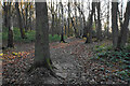
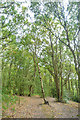
Path in West Wood
West Wood is ancient woodland managed by Chesterfield Borough Council. It was mentioned in the Domesday Book.
Image: © Bill Boaden
Taken: 15 Dec 2021
0.12 miles
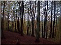
6
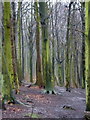
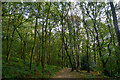
Beech trees in West Wood
Dense woodland above Trough Brook. The large housing estates of Inkersall Green are surprisingly close by, but a world away in some respects.
Image: © Andrew Hill
Taken: 5 Mar 2011
0.12 miles
7
Path in West Wood
West Wood is ancient woodland managed by Chesterfield Borough Council. It was mentioned in the Domesday Book.
Image: © Bill Boaden
Taken: 15 Dec 2021
0.13 miles
8
Brimington : West Wood
Looking across West Wood in Brimington.
Image: © Lewis Clarke
Taken: 2 Oct 2018
0.14 miles
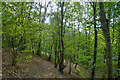
9
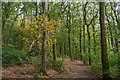
West Wood Near Inkersall Green
The path through this woodland forms part of the Chesterfield Round Walk.
Image: © Jonathan Clitheroe
Taken: 5 Nov 2011
0.14 miles
10
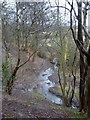
Wooded slopes above Trough Brook
The 1:25,000 map shows the twists of the brook in more detail. The path is quite steep in places, and the mud is very slippery when wet. The houses are largely out of sight and the little valley has a much wilder feel to it than expected when planning the walk in a new area for me.
Image: © Andrew Hill
Taken: 5 Mar 2011
0.15 miles