IMAGES TAKEN NEAR TO
Bole Hill, CHESTERFIELD, S42 6RF
Introduction
This page details the photographs taken nearby to Bole Hill, S42 6RF by members of the Geograph project.
The Geograph project started in 2005 with the aim of publishing, organising and preserving representative images for every square kilometre of Great Britain, Ireland and the Isle of Man.

There are currently over 7.5m images from over14,400 individuals and you can help contribute to the project by visiting https://www.geograph.org.uk
Image Map
Images are licensed for reuse under creativecommons.org/licenses/by-sa/2.0
Notes
- Clicking on the map will re-center to the selected point.
- The higher the marker number, the further away the image location is from the centre of the postcode.
Image Listing (23 Images Found)
Images are licensed for reuse under creativecommons.org/licenses/by-sa/2.0
Image
Details
Distance
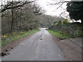
1
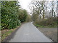
Bolehill Lane - Bolehill
View looking down hill towards Realstone Quarry
Image: © Alan Heardman
Taken: 8 Mar 2007
0.03 miles
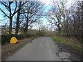
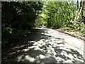
3
Bolehill Lane - Bolehill
Interesting wall with wheels.
Image: © Alan Heardman
Taken: 8 Mar 2007
0.06 miles
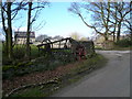
6
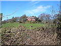
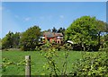
Bolehill - House with a View
Picture taken from Bolehill Lane.
Image: © Alan Heardman
Taken: 8 Mar 2007
0.08 miles
7
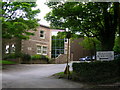
Realstone Quarries
The quarry office building is a visual display of the product.
Image: © John H Darch
Taken: 31 May 2006
0.09 miles
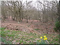
10
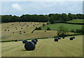
Fields below Bole Hill
Fields harvested for silage, seen from footpath crossing the field.
Image: © Andrew Hill
Taken: 16 Jun 2011
0.10 miles