IMAGES TAKEN NEAR TO
Bolehill Lane, CHESTERFIELD, S42 6BA
Introduction
This page details the photographs taken nearby to Bolehill Lane, S42 6BA by members of the Geograph project.
The Geograph project started in 2005 with the aim of publishing, organising and preserving representative images for every square kilometre of Great Britain, Ireland and the Isle of Man.

There are currently over 7.5m images from over14,400 individuals and you can help contribute to the project by visiting https://www.geograph.org.uk
Image Map
Images are licensed for reuse under creativecommons.org/licenses/by-sa/2.0
Notes
- Clicking on the map will re-center to the selected point.
- The higher the marker number, the further away the image location is from the centre of the postcode.
Image Listing (16 Images Found)
Images are licensed for reuse under creativecommons.org/licenses/by-sa/2.0
Image
Details
Distance
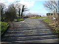
1
View from the top of Bole Hill
Looking south west towards Northedge.
Image: © Peter Barr
Taken: 28 Jul 2010
0.04 miles
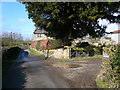
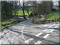
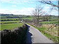
2
Acute lane junction
Press Lane (left) and Bolehill Lane (right and behind).
Image: © Andrew Hill
Taken: 14 Feb 2012
0.04 miles
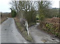
3
Bolehill Lane - Junction with Press Lane
Image: © Alan Heardman
Taken: 24 Feb 2007
0.05 miles
4
Grinderswell Lane - Junction with Press Lane
Image: © Alan Heardman
Taken: 24 Feb 2007
0.13 miles
5
Grinderswell Lane - Junction with Press Lane
Image: © Alan Heardman
Taken: 24 Feb 2007
0.14 miles
6
Press Farm from Redcar Hillside Plantation
Image: © Neil Theasby
Taken: 3 May 2014
0.15 miles
7
Old barn at Press Lane
At the junction with Grinderswell Lane, near Northedge.
Image: © Peter Barr
Taken: 28 Jul 2010
0.15 miles
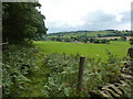
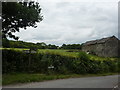
8

Farm on Press Lane
A few farms make up the scattered hamlet of Press.
Image: © Andrew Hill
Taken: 14 Feb 2012
0.16 miles
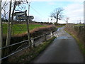
9
Bolehill Lane - View towards Press Fisheries
Image: © Alan Heardman
Taken: 8 Mar 2007
0.17 miles