
IMAGES TAKEN NEAR TO
Tibshelf Road, CHESTERFIELD, S42 5SZ
Introduction
This page details the photographs taken nearby to Tibshelf Road, S42 5SZ by members of the Geograph project.
The Geograph project started in 2005 with the aim of publishing, organising and preserving representative images for every square kilometre of Great Britain, Ireland and the Isle of Man.

There are currently over 7.5m images from over14,400 individuals and you can help contribute to the project by visiting https://www.geograph.org.uk
Image Map
Images are licensed for reuse under creativecommons.org/licenses/by-sa/2.0
Notes
- Clicking on the map will re-center to the selected point.
- The higher the marker number, the further away the image location is from the centre of the postcode.
Image Listing (19 Images Found)
Images are licensed for reuse under creativecommons.org/licenses/by-sa/2.0
Image
Details
Distance
1

Junction of Out Lane and the B6039
This southerly facing photograph is of the junction of Out Lane (left) with the B6039, Tibshelf Road (ahead).
The building on the right is Toll Bar Cottage (private dwelling).
The white-faced dwelling (private) on the left is called Weenan.
This junction is the end of the section of the B6039 (ahead, to the roundabout in Holmewood) called Tibshelf Road.
Behind the viewpoint the B6039 crosses Stainsby Common.
For another (westerly facing) photograph of the junction, click here Image
For another (southerly facing) photograph of the junction, click here Image
For a more southerly (behind the viewpoint) photograph of the B6039, click here Image
Image: © Alan Walker
Taken: 2 Nov 2007
0.11 miles
2

Tollhouse by the B6039, Tibshelf Road, Holmewood
Tollhouse by the B6039 at the junction with Out Lane, in the parish of Ault Hucknall (Bolsover District), Toll Bar Cottage, Tibshelf Road, Holmewood, S42 5SY.
Derbyshire HER.
HER No.: 266 https://www.heritagegateway.org.uk/Gateway/Results_Single.aspx?uid=MDR10129&resourceID=1023
Surveyed
Milestone Society National ID: DE.AUL02
Image: © Alan Rosevear
Taken: 31 May 2013
0.12 miles
3
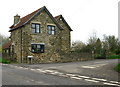
Toll Bar Cottage
On Stainsby Common at the corner of Out Lane with Tibshelf Road.
Image: © David Rogers
Taken: 15 Apr 2009
0.13 miles
4

Junction of Out Lane and the B6039
This westerly facing photograph is of the junction of Out Lane (foreground) with the B6039 (across the picture ahead).
The building on the right is Toll Bar Cottage.
This junction is the end of the section of the B6039 (between here and the roundabout in Holmewood) called Tibshelf Road.
For another (northerly facing) photograph of the junction, click here Image
For another (southerly facing) photograph of the junction, click here Image
For another photograph of the lane, taken from two or three metres behind viewpoint and facing the opposite (easterly) direction, click here Image
For a more easterly (behind the viewpoint) photograph of the lane, click here Image
Image: © Alan Walker
Taken: 2 Nov 2007
0.13 miles
5

View across fields
This photograph was taken from a Image connecting the Image¹ near Astwith (right, easterly) with North Wingfield (left, westerly).
The photograph was taken from the south-eastern corner of an autumn sown field. To see a similar photograph taken from the south-western corner of the same field, click here Image
The private dwellings in the distance are on Tibshelf Road¹ (B6039).
¹ Road name information from OS Maps at:-
Elgin, http://www.elgin.gov.uk/ and the
Mapping Portal of the Derbyshire Partnership, http://derbyshiremaps.derbyshire.gov.uk/
Image: © Alan Walker
Taken: 12 Nov 2007
0.15 miles
6
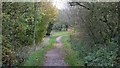
The Five Pits Trail Williamthorpe loop
Walking the Five Pits Trail loop around Holmewood and Williamthorpe
Image : Previous – (19 of 21) - Next : Image
This north-westerly facing photograph is of the Five Pits Trail loop via Holmewood to Williamthorpe Nature Reserve Five Pits Trail.
Ahead the trail crosses the busy Tibshelf Road (B6039). Behind the viewpoint the trail links with the main trail route toward either Tibshelf Ponds or Grassmoor Country Park.
See also these photographs, both taken behind this viewpoint, by:-
Neil Theasby:- Image and
Peter Barr:- Image
- - -
An OS map surveyed in 1914 and published in 1921 shows that this section of the trail follows the Midland Railway's Hardwick Colliery Branch line.
Image: © Alan Walker
Taken: 31 Oct 2017
0.16 miles
7
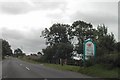
Welcome to Bolsover District
on the Chesterfield Road, Holmewood
Image: © Tom Courtney
Taken: 28 Aug 2005
0.17 miles
8
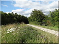
South of Williamsthorpe - Five Pits Trail
Image: © Neil Theasby
Taken: 30 Jul 2015
0.17 miles
9

Speeding for horses restricted
A sign on the Five Pits Trail, advising riders not to canter nor gallop.
Image: © Peter Barr
Taken: 24 Feb 2011
0.19 miles
10

View Towards Williamthorpe from the Five Pits Trail
Pictured on a fine autumnal Saturday afternoon.
Image: © Jonathan Clitheroe
Taken: 13 Oct 2012
0.19 miles