IMAGES TAKEN NEAR TO
St. Lawrence Road, CHESTERFIELD, S42 5HX
Introduction
This page details the photographs taken nearby to St. Lawrence Road, S42 5HX by members of the Geograph project.
The Geograph project started in 2005 with the aim of publishing, organising and preserving representative images for every square kilometre of Great Britain, Ireland and the Isle of Man.

There are currently over 7.5m images from over14,400 individuals and you can help contribute to the project by visiting https://www.geograph.org.uk
Image Map
Images are licensed for reuse under creativecommons.org/licenses/by-sa/2.0
Notes
- Clicking on the map will re-center to the selected point.
- The higher the marker number, the further away the image location is from the centre of the postcode.
Image Listing (44 Images Found)
Images are licensed for reuse under creativecommons.org/licenses/by-sa/2.0
Image
Details
Distance
2
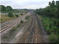
View of Bridge at Bottom of Church Hill (Erewash Line)
Image: © Alan Heardman
Taken: 12 Sep 2000
0.04 miles
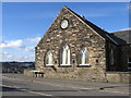
3
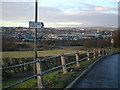
View Towards Coney Green From St Lawrence Church
Image: © Alan Heardman
Taken: 23 Jan 2000
0.04 miles
4
Bridge Widening (St Lawrences Church Background)
Image: © Alan Heardman
Taken: 29 Sep 2003
0.04 miles
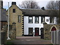
6
The Blue Bell Inn - Rear view from Cemetery
Image: © Alan Heardman
Taken: 17 Aug 2007
0.04 miles
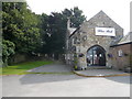
9
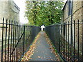
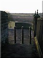
Narrow Pathway
Narrow pathway with tall metal railings, to the East of St Lawrence Church, North Wingfield.
Image: © Tony Bacon
Taken: 14 Oct 2020
0.06 miles
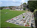
10
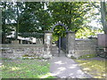
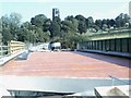
North Wingfield - Walkway through the Cemetery
This view shows the gravestones on the left hand side of the path, whilst the main cemetery is on the right hand side.
Image
Image: © Alan Heardman
Taken: 17 Aug 2007
0.06 miles