IMAGES TAKEN NEAR TO
Hady Lane, CHESTERFIELD, S41 0DQ
Introduction
This page details the photographs taken nearby to Hady Lane, S41 0DQ by members of the Geograph project.
The Geograph project started in 2005 with the aim of publishing, organising and preserving representative images for every square kilometre of Great Britain, Ireland and the Isle of Man.

There are currently over 7.5m images from over14,400 individuals and you can help contribute to the project by visiting https://www.geograph.org.uk
Image Map
Images are licensed for reuse under creativecommons.org/licenses/by-sa/2.0
Notes
- Clicking on the map will re-center to the selected point.
- The higher the marker number, the further away the image location is from the centre of the postcode.
Image Listing (13 Images Found)
Images are licensed for reuse under creativecommons.org/licenses/by-sa/2.0
Image
Details
Distance
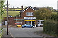
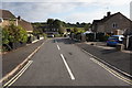
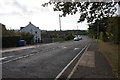
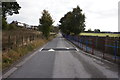
5
Hady Lane, Calow
Looking up the hill past the short spur of The Clough.
Image: © Andrew Hill
Taken: 20 Jun 2011
0.17 miles
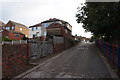
8
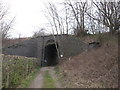
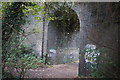
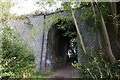
Bridge under the dismantled railway at Dingle Bank
Image: © John Slater
Taken: 22 Mar 2016
0.22 miles