
IMAGES TAKEN NEAR TO
Peak View Road, CHESTERFIELD, S40 4NW
Introduction
This page details the photographs taken nearby to Peak View Road, S40 4NW by members of the Geograph project.
The Geograph project started in 2005 with the aim of publishing, organising and preserving representative images for every square kilometre of Great Britain, Ireland and the Isle of Man.

There are currently over 7.5m images from over14,400 individuals and you can help contribute to the project by visiting https://www.geograph.org.uk
Image Map
Images are licensed for reuse under creativecommons.org/licenses/by-sa/2.0
Notes
- Clicking on the map will re-center to the selected point.
- The higher the marker number, the further away the image location is from the centre of the postcode.
Image Listing (18 Images Found)
Images are licensed for reuse under creativecommons.org/licenses/by-sa/2.0
Image
Details
Distance
1
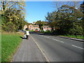
Pennine Way, Chesterfield
A suburban road, not the long distance footpath.
Image: © Christine Johnstone
Taken: 18 Oct 2018
0.07 miles
2
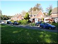
Houses in Nevis Close, Chesterfield
Seen from the public footpath that follows Holme Brook.
Image: © Christine Johnstone
Taken: 18 Oct 2018
0.08 miles
3
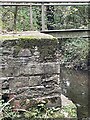
Loundsley Green, Brockwell Lane
OS BM on bridge
Sk 3653 7218
Image: © mralrule
Taken: 28 Oct 2021
0.11 miles
4
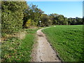
Path at the edge of the playing field, alongside Holme Brook
At the sign the visible path changes from a public bridleway [near] to a public footpath [far].
Image: © Christine Johnstone
Taken: 18 Oct 2018
0.12 miles
5
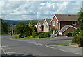
Larch Way past Cedar Avenue
A residential street in suburban Chesterfield.
Image: © Andrew Hill
Taken: 20 Jun 2011
0.14 miles
6
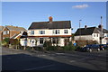
Houses at the junction of Larch Way and Brockwell Lane
Image: © Roger Templeman
Taken: 27 Feb 2020
0.16 miles
8

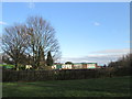
Brockwell Lane, Loundsley Green
This path follows the course of Holme Brook and is seen here skirting playing fields at Loundsley Green.
Image: © Jonathan Clitheroe
Taken: 27 Oct 2012
0.16 miles
9
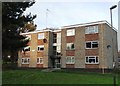
Riber Court, Chesterfield
Social housing by Pennine Way
Image: © Neil Theasby
Taken: 26 Nov 2013
0.18 miles
10
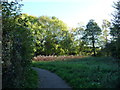
Public footpath, Ashgate valley, Chesterfield
On the north bank of Holme Brook.
Image: © Christine Johnstone
Taken: 18 Oct 2018
0.19 miles