IMAGES TAKEN NEAR TO
Brookbank Avenue, CHESTERFIELD, S40 4BA
Introduction
This page details the photographs taken nearby to Brookbank Avenue, S40 4BA by members of the Geograph project.
The Geograph project started in 2005 with the aim of publishing, organising and preserving representative images for every square kilometre of Great Britain, Ireland and the Isle of Man.

There are currently over 7.5m images from over14,400 individuals and you can help contribute to the project by visiting https://www.geograph.org.uk
Image Map
Images are licensed for reuse under creativecommons.org/licenses/by-sa/2.0
Notes
- Clicking on the map will re-center to the selected point.
- The higher the marker number, the further away the image location is from the centre of the postcode.
Image Listing (14 Images Found)
Images are licensed for reuse under creativecommons.org/licenses/by-sa/2.0
Image
Details
Distance
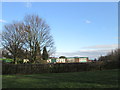
1
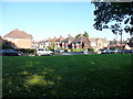
Brooklyn Drive, off Ashgate Valley Road, Chesterfield
On the north bank of Holme brook.
Image: © Christine Johnstone
Taken: 18 Oct 2018
0.05 miles
2
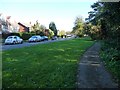
Public footpath alongside Ashgate Valley Road
Close to, but not part of, the pavement.
Image: © Christine Johnstone
Taken: 18 Oct 2018
0.06 miles
4
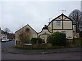
Shaftesbury Avenue
House on the junction with Ashgate Road.
Image: © Peter Barr
Taken: 8 Jan 2013
0.16 miles
6
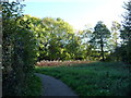
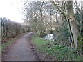
Public footpath, Ashgate valley, Chesterfield
On the north bank of Holme Brook.
Image: © Christine Johnstone
Taken: 18 Oct 2018
0.17 miles
7
Houses at the junction of Larch Way and Brockwell Lane
Image: © Roger Templeman
Taken: 27 Feb 2020
0.17 miles
8
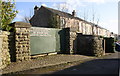
Entrance to Clubmill Reservoir House and Clubmill Terrace houses
Ordnance Survey records indicate that a benchmark was levelled at 116.711m above Newlyn Datum in 1961 on an outbuilding of the nearest house (#15 Clubmill Terrace)
Image: © Luke Shaw
Taken: 27 Feb 2020
0.18 miles
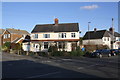
9
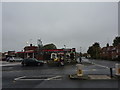
Petrol Station, Ashgate Road
At the junction with Chester Street.
Image: © Peter Barr
Taken: 22 Oct 2012
0.19 miles
10
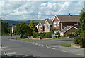
Larch Way past Cedar Avenue
A residential street in suburban Chesterfield.
Image: © Andrew Hill
Taken: 20 Jun 2011
0.20 miles