
IMAGES TAKEN NEAR TO
Ashgate Road, CHESTERFIELD, S40 4AL
Introduction
This page details the photographs taken nearby to Ashgate Road, S40 4AL by members of the Geograph project.
The Geograph project started in 2005 with the aim of publishing, organising and preserving representative images for every square kilometre of Great Britain, Ireland and the Isle of Man.

There are currently over 7.5m images from over14,400 individuals and you can help contribute to the project by visiting https://www.geograph.org.uk
Image Map
Images are licensed for reuse under creativecommons.org/licenses/by-sa/2.0
Notes
- Clicking on the map will re-center to the selected point.
- The higher the marker number, the further away the image location is from the centre of the postcode.
Image Listing (18 Images Found)
Images are licensed for reuse under creativecommons.org/licenses/by-sa/2.0
Image
Details
Distance
1
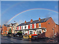
Ashgate rainbow
By the time I took this photograph, I had been watching this same rainbow for some 45 minutes. The full rainbow arch remained bright throughout this time, in spite of the almost cloudless sky. Just a fine drizzle of rain was reaching the ground.
This view is over housing in Ashgate Road, at the junction with Langhurst Road.
Image: © Richard Dorrell
Taken: 15 Nov 2015
0.05 miles
2
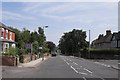
Ashgate Road, Ashgate
Looking east towards Chesterfield
Image: © Stephen G Taylor
Taken: 21 Jul 2006
0.08 miles
3
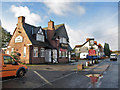
The Crispin Public House, Ashgate Road
The pub is currently closed with lease available to rent.
Image: © Richard Dorrell
Taken: 15 Nov 2015
0.10 miles
6
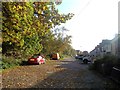
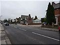
Langhurst Road in Ashgate
A western suburb of Chesterfield.
Image: © Jonathan Clitheroe
Taken: 27 Oct 2012
0.13 miles
7
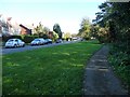
Public footpath alongside Ashgate Valley Road
Close to, but not part of, the pavement.
Image: © Christine Johnstone
Taken: 18 Oct 2018
0.13 miles
8
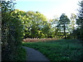
Public footpath, Ashgate valley, Chesterfield
On the north bank of Holme Brook.
Image: © Christine Johnstone
Taken: 18 Oct 2018
0.14 miles
9
Brooklyn Drive, off Ashgate Valley Road, Chesterfield
On the north bank of Holme brook.
Image: © Christine Johnstone
Taken: 18 Oct 2018
0.15 miles
10
Houses on Springfield Avenue
A suburban street in Ashgate, Chesterfield. View from the end of Shaftesbury Avenue.
Image: © Andrew Hill
Taken: 20 Jun 2011
0.16 miles