IMAGES TAKEN NEAR TO
West Lea, CHESTERFIELD, S40 3SL

Introduction

This page details the photographs taken nearby to West Lea, S40 3SL by members of the Geograph project.

The Geograph project started in 2005 with the aim of publishing, organising and preserving representative images for every square kilometre of Great Britain, Ireland and the Isle of Man.

There are currently over 7.5m images from over14,400 individuals and you can help contribute to the project by visiting https://www.geograph.org.uk

Image Map


Images are licensed for reuse under creativecommons.org/licenses/by-sa/2.0
Notes
  • Clicking on the map will re-center to the selected point.
  • The higher the marker number, the further away the image location is from the centre of the postcode.

Image Listing (13 Images Found)

Images are licensed for reuse under creativecommons.org/licenses/by-sa/2.0
Image
Details
Distance
1
Entrance to modern business premises in Chesterfield
The company (CSC) describe themselves as "a global leader of next-generation information technology (IT) services and solutions. Our mission is to enable superior returns on clients' technology investments through best-in-class industry solutions, domain expertise and global scale."
Image: © Neil Theasby Taken: 26 Nov 2013
0.14 miles
2
Road junction, Old Road and Storrs Road
A busy suburban junction on the western fringe of Chesterfield.
Image: © Andrew Hill Taken: 3 Jun 2011
0.17 miles
3
Storrs Road, Chesterfield
Image: © Andrew Loughran Taken: 4 Mar 2006
0.18 miles
4
Pollarded avenue of trees, snow and long shadows
Off Old Road, Ashgate, Chesterfield
Image: © Peter Barr Taken: 7 Jan 2010
0.19 miles
5
Slack Lane, Ashgate in Chesterfield.
Slack Lane, Ashgate, Chesterfield; looking north from junction with Old Road.
Image: © Andrew Loughran Taken: 4 Mar 2006
0.20 miles
6
Manor Road, Chesterfield - under a mackerel sky
Image: © Neil Theasby Taken: 26 Nov 2013
0.20 miles
7
Storrs Road, Chesterfield
Image: © Peter Barr Taken: 18 Jan 2010
0.22 miles
8
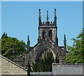
Glimpse of a church from Heaton Street
St Thomas' Brampton, further west along Chatsworth Road - a glimpse of the tower over the rooftops.
Image: © Andrew Hill Taken: 3 Jun 2011
0.23 miles
9
Brampton - St Thomas Church tower
For an alternative view, please see Andrew Hill's Image
Image: © Dave Bevis Taken: 7 Oct 2012
0.23 miles
10
St Thomas's Church in Brampton, Chesterfield
Image: © Neil Theasby Taken: 26 Nov 2013
0.24 miles