1
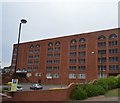
Ragged School Evangelical Church
It claims to be a non-denominational church. It is a clear landmark on Markham Road which passes on the right.
Image: © Bill Boaden
Taken: 2 Feb 2015
0.01 miles
2
Chesterfield Ragged School
This building was originally a lace factory but in 1878 it became a 'ragged school', part of a Victorian movement to provide free Sunday schools for the poorest children. It is recorded that 109 children turned up on the first day and the institution continued to thrive right through until the Second World War. After the war, however, in an age of the welfare state, the concept of a ragged school began to be seen as an anachronism. Furthermore, here at Chesterfield, the slum dwellings that had surrounded the building were disappearing. Nevertheless, the establishment did survive and continues to do so as a place of worship, now known as the 'Ragged School Evangelical Church', although Sunday schools are no longer held. A full history is available here: https://raggedschoolchesterfield.wordpress.com/essay/
Image: © Stephen McKay
Taken: 14 Aug 2018
0.01 miles
3
Chesterfield Coach Station
Situated on Beetwell Street and opened in May 2005, having replaced a previous station on the site.
Image: © Jonathan Clitheroe
Taken: 5 May 2012
0.02 miles
4
Chesterfield coach station
The station is set on the slope rising from Markham Road up to New Beetwell Street on the right. The main shopping area is just across the latter road to the north.
Image: © Andrew Hill
Taken: 16 Nov 2010
0.02 miles
5
A619
Image: © N Chadwick
Taken: 30 Aug 2015
0.02 miles
6
Chesterfield Coach Station
Coach station seems a slightly pretentious name for this modest facility on the site of the old bus station; certainly the two vehicles seen here are on ordinary stage carriage services. The double decker is a Stagecoach Gold branded bus on the X17 Sheffield - Matlock route; the other vehicle belongs to Hulleys of Baslow and is also on a Matlock service albeit via a different route. Hulleys is a long-established Peak District operator that traces its origins back to 1921; despite all the turmoil in the bus industry it has survived although it is no longer owned by the Hulley family.
Image: © Stephen McKay
Taken: 14 Aug 2018
0.02 miles
7
Offices, Chesterfield
Image: © N Chadwick
Taken: 30 Aug 2015
0.03 miles
8
Chesterfield Coach Station
On the southern edge of the town centre
Image: © Graham Hogg
Taken: 30 Jan 2013
0.03 miles
9
More red lights
Following the A619 through Chesterfield at traffic lights outside the retail development on the fringe of the town centre.
Image: © Peter Turner
Taken: 19 Apr 2011
0.03 miles
10
Chesterfield Bus Station
It is small compared with some, but operates efficiently enough.
Image: © Bill Boaden
Taken: 2 Feb 2015
0.03 miles


