
IMAGES TAKEN NEAR TO
Packers Row, CHESTERFIELD, S40 1RE
Introduction
This page details the photographs taken nearby to Packers Row, S40 1RE by members of the Geograph project.
The Geograph project started in 2005 with the aim of publishing, organising and preserving representative images for every square kilometre of Great Britain, Ireland and the Isle of Man.

There are currently over 7.5m images from over14,400 individuals and you can help contribute to the project by visiting https://www.geograph.org.uk
Image Map
Images are licensed for reuse under creativecommons.org/licenses/by-sa/2.0
Notes
- Clicking on the map will re-center to the selected point.
- The higher the marker number, the further away the image location is from the centre of the postcode.
Image Listing (709 Images Found)
Images are licensed for reuse under creativecommons.org/licenses/by-sa/2.0
Image
Details
Distance
1
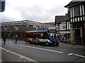
Bus on Knifesmithgate, Chesterfield
A bus waits on Knifesmithgate at its junction with Packers Row, operating service 39, which is the most frequent bus route in Chesterfield.
Image: © Richard Vince
Taken: 14 Apr 2012
0.01 miles
2
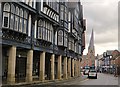
Knifesmithgate, Chesterfield
The mock-Tudor, black-and-white buildings were designed in the 1920s and 30s by architects who took their inspiration from Chester’s ‘Rows’.
Image: © Paul Harrop
Taken: 9 Nov 2017
0.01 miles
3
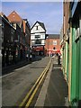
Chesterfield - Packers Row (North View)
Image: © Alan Heardman
Taken: 21 Nov 2000
0.01 miles
4
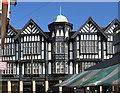
Chesterfield - shops on Knifesmithgate
The half-timbered frontages as seen from Packers Row.
Image: © Dave Bevis
Taken: 13 Mar 2013
0.01 miles
5
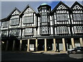
Neo-Tudor on Knifesmithgate, Chesterfield
Chesterfield has several blocks of Neo Tudor buildings in the town centre. Many incorporate colonnaded walks which were a feature of many earlier buildings in the town.
Image: © Jonathan Thacker
Taken: 24 Feb 2023
0.01 miles
6
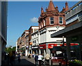
High Street shops, Chesterfield
Looking along the pedestrianised High Street as it approaches the market place from the east.
Image: © Andrew Hill
Taken: 20 Jun 2011
0.02 miles
7
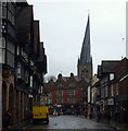
Knifesmithgate, Chesterfield, Derbys.
Looking towards Stephenson Place from Knifesmithgate.
Image: © David Hallam-Jones
Taken: 22 Nov 2014
0.02 miles
8
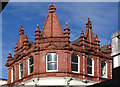
Chesterfield - Santander Bank
View of the decorative brickwork on the top floor of the bank (on the corner of Burlington Street with Packers Row).
Image: © Dave Bevis
Taken: 13 Mar 2013
0.02 miles
9
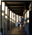
Pedestrian colonnade, Knifesmithgate
A covered pavement by the timber framed shops on Knifesmithgate, Chesterfield.
Image: © Andrew Hill
Taken: 16 Nov 2010
0.02 miles
10
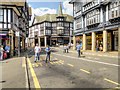
Knifesmithgate, Chesterfield
Parts of the town centre were modernised in the 1920s and 1930s by the introduction of a mock-Tudor style of architecture. Knifesmithgate was given a further facelift in the 1960s.
Image: © David Dixon
Taken: 4 Aug 2014
0.02 miles