
IMAGES TAKEN NEAR TO
Bramwell Street, SHEFFIELD, S3 7PF
Introduction
This page details the photographs taken nearby to Bramwell Street, S3 7PF by members of the Geograph project.
The Geograph project started in 2005 with the aim of publishing, organising and preserving representative images for every square kilometre of Great Britain, Ireland and the Isle of Man.

There are currently over 7.5m images from over14,400 individuals and you can help contribute to the project by visiting https://www.geograph.org.uk
Image Map
Images are licensed for reuse under creativecommons.org/licenses/by-sa/2.0
Notes
- Clicking on the map will re-center to the selected point.
- The higher the marker number, the further away the image location is from the centre of the postcode.
Image Listing (221 Images Found)
Images are licensed for reuse under creativecommons.org/licenses/by-sa/2.0
Image
Details
Distance
2
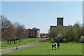
St Stephen's Church, Netherthorpe, viewed from The Ponderosa, Sheffield
For a full description about The Ponderosa. follow this link ... http://en.wikipedia.org/wiki/Ponderosa_(Sheffield) ... see also Image See also ... Image Image
Image: © Terry Robinson
Taken: 17 Apr 2010
0.06 miles
3
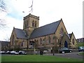
St Stephen's Church, Netherthorpe, Sheffield - 1
This fine looking church has dominated this part of Sheffield for over 100 years and has witnessed many changes to the surrounding areas. Follow this link for more information about the church ... http://ststephenschurch.org.uk/content/ ... see also ... Image Image
Image: © Terry Robinson
Taken: 26 Mar 2010
0.07 miles
4
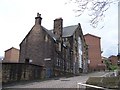
Bethany School, Finlay Street, Netherthorpe, Sheffield - 2
To the left of the main building, up the steep and still cobbled street,
is the second part of the school ... probably, originally for the infants … see …
Image
Image: © Terry Robinson
Taken: 7 Apr 2010
0.07 miles
5
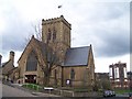
St Stephen's Church, Netherthorpe, Sheffield - 2
Two of Upperthorpe's six tower blocks - namely Albion and Oxford - are visible in the background ... the parkland area, known as The Ponderosa, separates them. For another view of the church, see ... Image ... to see aplan of The Ponderosa (and find a link) see ... Image
Image: © Terry Robinson
Taken: 7 Apr 2010
0.07 miles
6
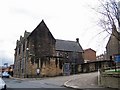
Bethany School, Finlay Street, Netherthorpe, Sheffield - 1
The main part of the school is viewed here, with the (probable)
infants building is just off picture to the left … see ...
Image
Image: © Terry Robinson
Taken: 7 Apr 2010
0.07 miles
7
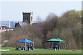
'Challenge' at The Ponderosa, Upperthorpe, Sheffield
To see a poster of The Ponderosa Challenge, see ... Image ... For a full description of The Ponderosa, follow this ... http://en.wikipedia.org/wiki/Ponderosa_(Sheffield) ... see also Image Image ... St Stephen's Church, Netherthorpe, is in the background.
Image: © Terry Robinson
Taken: 17 Apr 2010
0.08 miles
8
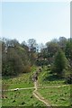
'Crossroads' at The Ponderosa, Upperthorpe, Sheffield
The path running from front to back leads from Upperthorpe across and up the steps to the Netherthorpe area ... the path running across the picture leads from Crookesmoor - on the right - down to lower Upperthorpe and the Infirmary area. For a full description of The Ponderosa, follow this link ... http://en.wikipedia.org/wiki/Ponderosa_(Sheffield) ... see also Image
Image: © Terry Robinson
Taken: 17 Apr 2010
0.08 miles
9
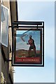
Pub Sign, The Boomerang, Netherthorpe, Sheffield
Image: © Terry Robinson
Taken: 26 Mar 2010
0.08 miles
10
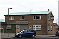
The Boomerang, Fawcett Street, Netherthorpe, Sheffield
Image: © Terry Robinson
Taken: 7 Apr 2010
0.09 miles