IMAGES TAKEN NEAR TO
Well Meadow Street, SHEFFIELD, S3 7GS
Introduction
This page details the photographs taken nearby to Well Meadow Street, S3 7GS by members of the Geograph project.
The Geograph project started in 2005 with the aim of publishing, organising and preserving representative images for every square kilometre of Great Britain, Ireland and the Isle of Man.

There are currently over 7.5m images from over14,400 individuals and you can help contribute to the project by visiting https://www.geograph.org.uk
Image Map
Images are licensed for reuse under creativecommons.org/licenses/by-sa/2.0
Notes
- Clicking on the map will re-center to the selected point.
- The higher the marker number, the further away the image location is from the centre of the postcode.
Image Listing (232 Images Found)
Images are licensed for reuse under creativecommons.org/licenses/by-sa/2.0
Image
Details
Distance
1
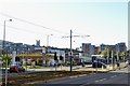
Netherthorpe Road, viewed from Hoyle Street, Shalesmoor, Sheffield
In the early 1960s, Netherthorpe Road was developed and made into a
dual carriageway as part of Sheffield's Inner Ring Road.
The road was again developed and widened in the late 1990s to enable the
then newly formed Sheffield Supertram to use the central section.
Visible is the foreground is the Shell Petrol Station
with the NHS' Netherthorpe House to the right
For more information … see …
Image
Image
At the top of the hill is the Atlantic 1 Student Accommodation Block
and to the left is the Steeple of St George's Church, now used by
the University of Sheffield as a Lecture Theatre
Image: © Terry Robinson
Taken: 24 Oct 2013
0.02 miles
2
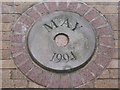
Netherthorpe Road tram stop
The subway at the Netherthorpe Road tram stop indicates the date of construction.
Image: © Dave Pickersgill
Taken: 21 Jul 2012
0.02 miles
3
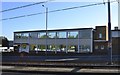
Netherthorpe House, Netherthorpe Road, Shalesmoor, Sheffield - 1
As seen in a Picture Sheffield view … this building was under construction in 1967.
My recollection is that it used to owned by a company called Escafeld … but I have no proof!
It is now used by the NHS' Sheffield Health and Social Care Department,
for their Northern Region Art Therapy Programme
See also …
Image
Image
Image: © Terry Robinson
Taken: 24 Oct 2013
0.04 miles
4
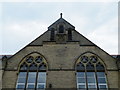
Sheffield School Board Detail on Netherthorpe Primary School, Netherthorpe Street, Sheffield
Image: © Terry Robinson
Taken: 12 Aug 2012
0.05 miles
5
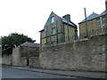
Caretaker's House (former) at Netherthorpe Primary School, Dover Street, Netherthorpe, Sheffield - 1
Image: © Terry Robinson
Taken: 12 Aug 2012
0.05 miles
6
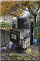
Waste Disposal Chute, near Jericho Street Flats, Netherthorpe, Sheffield
This strange looking concrete structure is part of the central
waste disposal system for the nearby flats on Jericho Street
Image: © Terry Robinson
Taken: 15 Nov 2013
0.05 miles
7
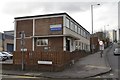
Netherthorpe House, Netherthorpe Road, Shalesmoor, Sheffield - 2
Image: © Terry Robinson
Taken: 15 Nov 2013
0.05 miles
8
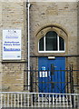
Boys Entrance at Netherthorpe Primary School, Netherthorpe Street, Netherthorpe, Sheffield - 1
Image: © Terry Robinson
Taken: 12 Aug 2012
0.05 miles
9
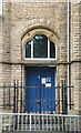
Girls & Infants Entrance at Netherthorpe Primary School, Netherthorpe Street, Sheffield - 1
Image: © Terry Robinson
Taken: 12 Aug 2012
0.05 miles