
IMAGES TAKEN NEAR TO
Kirk Edge Drive, SHEFFIELD, S35 0AZ
Introduction
This page details the photographs taken nearby to Kirk Edge Drive, S35 0AZ by members of the Geograph project.
The Geograph project started in 2005 with the aim of publishing, organising and preserving representative images for every square kilometre of Great Britain, Ireland and the Isle of Man.

There are currently over 7.5m images from over14,400 individuals and you can help contribute to the project by visiting https://www.geograph.org.uk
Image Map
Images are licensed for reuse under creativecommons.org/licenses/by-sa/2.0
Notes
- Clicking on the map will re-center to the selected point.
- The higher the marker number, the further away the image location is from the centre of the postcode.
Image Listing (95 Images Found)
Images are licensed for reuse under creativecommons.org/licenses/by-sa/2.0
Image
Details
Distance
1
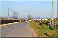
Kirk Edge Road and Kirk Edge Drive, Worrall, near Oughtibridge
The white pointy buildings are on Kirk Edge Drive
Image: © Terry Robinson
Taken: 20 Apr 2013
0.01 miles
2
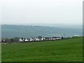
Kirk Edge Drive from Darwent Lane, Worrall, near Oughtibridge
Image: © Terry Robinson
Taken: 4 May 2008
0.04 miles
3
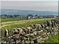
Looking over Worrall
A suburban village to the north west of the city, viewed here from the Sheffield Country Walk, a 53.4 mile walk encircling the entire city of Sheffield.
Image: © Graham Hogg
Taken: 8 Sep 2023
0.04 miles
4
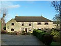
Worrall Hall
Worrall Hall is possibly the oldest building in the village but it has three distinct sections all of different time periods. The Hall was formerly a listed building but was taken of the list in 1985, it is a private house and has undergone much renovation work in recent years after becoming run down.
Image: © Graham Hogg
Taken: 26 Jan 2012
0.05 miles
5
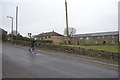
Trying out the Tour de France Route, Kirk Edge Road, Worrall, near Oughtibridge
Trying out the route is currently a popular pastime …
… another four riders are ahead ! … see …
Image
Image: © Terry Robinson
Taken: 8 Mar 2014
0.06 miles
6
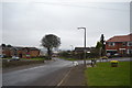
Tour de France 2014 Route - Worrall, near Oughtibridge - 3
Continuing on from Picture 2 … This is the junction of Kirk Edge Road with
Long Lane on the right and Top Road on the left. Still down hill at this point.
That seat looks like a handy viewing point !!
For more Tour de France Route views in the Worrall area … see …
Image
Image
Image
Image
Image
Image
Image: © Terry Robinson
Taken: 8 Mar 2014
0.08 miles
7
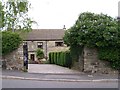
Worrall Hall, Worrall, near Oughtibridge - 1
This lovely restored building dates from 1720 ... and still has the original Coat-of-Arms plaque above the door. Worrall Hall Farm is just to the right rear of this building. Image
Image: © Terry Robinson
Taken: 21 May 2008
0.09 miles
8
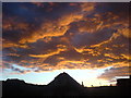
Sunset over Worrall
Sunset over Worrall 2
Image: © Stan Atkinson
Taken: 3 Sep 2007
0.09 miles
9
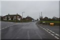
Tour de France 2014 Route - Worrall, near Oughtibridge - 4
This is the opposite view of Picture 3 … the riders will approach from the
top and pass the viewpoint - downhill and quickly I would imagine!
Long Lane is on the left, Top Road on the right.
That seat is still available … and looking good !!
For more Tour de France Route views in the Worrall area … see …
Image
Image
Image
Image
Image
Image
Image: © Terry Robinson
Taken: 8 Mar 2014
0.09 miles
10
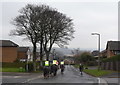
Cyclist and Riders on Kirk Edge Road, Worrall, near Oughtibridge
As requested … the cyclist, enjoying himself on this part of the
forthcoming Tour de France route, passed (very) wide and (very) slow
For more information … see …
Image
For more views … see …
Image
Image
Image
… and …
Image
Image: © Terry Robinson
Taken: 8 Mar 2014
0.09 miles