
IMAGES TAKEN NEAR TO
Lund Road, SHEFFIELD, S35 0AN
Introduction
This page details the photographs taken nearby to Lund Road, S35 0AN by members of the Geograph project.
The Geograph project started in 2005 with the aim of publishing, organising and preserving representative images for every square kilometre of Great Britain, Ireland and the Isle of Man.

There are currently over 7.5m images from over14,400 individuals and you can help contribute to the project by visiting https://www.geograph.org.uk
Image Map
Images are licensed for reuse under creativecommons.org/licenses/by-sa/2.0
Notes
- Clicking on the map will re-center to the selected point.
- The higher the marker number, the further away the image location is from the centre of the postcode.
Image Listing (70 Images Found)
Images are licensed for reuse under creativecommons.org/licenses/by-sa/2.0
Image
Details
Distance
1
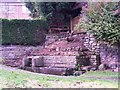
Lingard Well at Worrall
The clearance of some trees and overgrowth has made the ancient well and water trough much more visible.
Image: © Terry Robinson
Taken: 3 Nov 2008
0.02 miles
2
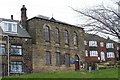
Chapel in Worrall, from Hagg Stones Road
Image: © Terry Robinson
Taken: 16 Mar 2008
0.04 miles
3
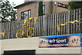
Yellow bikes promoting 'Le Grand D?part': The Blue Ball
The 2014 Tour de France is starting in Yorkshire and on day 2 will end in Sheffield. To promote the event 40 reclaimed bikes have been painted yellow and placed at various locations on the route and around the city. This one is in the car park of the Blue Ball pub, which has been given a fresh coat of yellow paint for the occasion. Image
Image: © Graham Hogg
Taken: 11 Jun 2014
0.04 miles
4
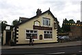
The Blue Ball, ready for 'Le Grand D?part'
The pub has been given a fresh coat of yellow paint, in keeping with the spirit of 'Le Grand Depart', the second stage in the 2014 Tour de France which will pass by in July. Here's what it previously looked like Image
Image: © Graham Hogg
Taken: 11 Jun 2014
0.04 miles
5
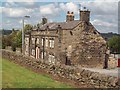
Public House in Worrall
The Shoulder of Mutton on Top Road in Worrall. I've included this http://www.shoulderofmuttoninn.co.uk/ to a concise potted history of the pub provided by Doug Sanderson and Malcolm Nunn.
Image: © Jonathan Clitheroe
Taken: 5 Aug 2011
0.04 miles
6
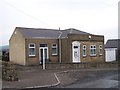
Bungalow, (former Co-op Store), Towngate Road, Worrall
Unusual design but strangely attractive and interesting.
Update in 2012 ...
I have been contacted by a 'viewer' who grew up in the Worrall area and he tells me that this building was built as the Co-operative Store and was converted to living premises in the 1960s. Looking again at the design, this does look to be the case. I believe that this would have been a branch of the Oughtibridge Co-operative Society.
Image: © Terry Robinson
Taken: 4 May 2008
0.04 miles
9
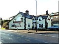
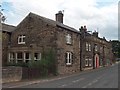
The Blue Ball
The pub is believed to have been originally two cottages which were connected at some time to make bigger premises. It was registered as a public house in the Sheffield Directory in 1851 but is probably older.
Image: © Graham Hogg
Taken: 26 Jan 2012
0.04 miles
10
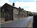
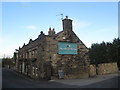
Shoulder of Mutton Pub at Worrall
Situated on Top Road, the "Shoulder" is one of two pubs in the village of Worrall, it is thought that parts of the structure were originally farm buildings before becoming licensed premises in the 1800s.
Image: © Michael Knapton
Taken: 29 May 2005
0.04 miles