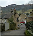
IMAGES TAKEN NEAR TO
The Dale, HOPE VALLEY, S32 5RP

Introduction

This page details the photographs taken nearby to The Dale, S32 5RP by members of the Geograph project.

The Geograph project started in 2005 with the aim of publishing, organising and preserving representative images for every square kilometre of Great Britain, Ireland and the Isle of Man.

There are currently over 7.5m images from over14,400 individuals and you can help contribute to the project by visiting https://www.geograph.org.uk

Image Map


Images are licensed for reuse under creativecommons.org/licenses/by-sa/2.0
Notes
  • Clicking on the map will re-center to the selected point.
  • The higher the marker number, the further away the image location is from the centre of the postcode.

Image Listing (264 Images Found)

Images are licensed for reuse under creativecommons.org/licenses/by-sa/2.0
  • ...
Image
Details
Distance
1
Cottages near Lydgate Graves, Eyam
Close to road junction; approx. SK220763
Image: © Dave Dunford Taken: 28 Mar 2004
0.01 miles
2
Eyam village
The centre of Eyam village.
Image: © Peter Mackenzie Taken: 4 Dec 2018
0.02 miles
3
Cut Mark Eyam Dale
see above
Image: © Monica Stagg Taken: 7 Apr 2014
0.02 miles
4
The Lydgate Graves
The graves of George Darby (died 4th July 1666) and his daughter Mary (died 4th September 1666)
Image: © David Smith Taken: 31 Aug 2017
0.03 miles
5
Entering Eyam from the south
This is a track that comes up from Stoney Middleton. Eyam Edge is beyond.
Image: © Bill Boaden Taken: 29 Nov 2008
0.05 miles
6
B6521, Eyam
Image: © N Chadwick Taken: 29 Aug 2015
0.05 miles
7
Lydgate, Eyam
A lovely village side street with character cottages.
Image: © Andrew Hill Taken: 16 Feb 2012
0.05 miles
8
Eyam Tea Rooms and The Causeway
Image: © Michael Garlick Taken: 27 Apr 2016
0.06 miles
9
A nameless street, Eyam
Image: © Benjamin Hopkins Taken: 30 Jan 2010
0.07 miles
10
Eyam: Where Church Street forks in two
Image: © Michael Garlick Taken: 27 Apr 2016
0.07 miles
  • ...