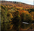
IMAGES TAKEN NEAR TO
Riddings Lane, HOPE VALLEY, S32 3YT

Introduction

This page details the photographs taken nearby to Riddings Lane, S32 3YT by members of the Geograph project.

The Geograph project started in 2005 with the aim of publishing, organising and preserving representative images for every square kilometre of Great Britain, Ireland and the Isle of Man.

There are currently over 7.5m images from over14,400 individuals and you can help contribute to the project by visiting https://www.geograph.org.uk

Image Map


Images are licensed for reuse under creativecommons.org/licenses/by-sa/2.0
Notes
  • Clicking on the map will re-center to the selected point.
  • The higher the marker number, the further away the image location is from the centre of the postcode.

Image Listing (63 Images Found)

Images are licensed for reuse under creativecommons.org/licenses/by-sa/2.0
  • ...
Image
Details
Distance
1
Footpath along the river Derwent
This path runs east then south along the bank of the river Derwent. Himalayan balsam lines the path on both sides.
Image: © Roger Temple Taken: 15 Sep 2007
0.08 miles
2
Calver Weir and Curbar Edge
The recently-renovated weir from above, with Curbar Edge behind.
Image: © Andy Stephenson Taken: 1 Nov 2011
0.09 miles
3
Field entrance on Riddings Lane
Image: © David Martin Taken: 28 Aug 2016
0.10 miles
4
River Derwent, above the weir, New Bridge
The view Image]showed the results of pulling up Himalayan Balsam in July 2010, and over a year later there are virtually no traces of this invasive plant at this stretch of riverside. Pulling out the plants before they can set and disperse their seed, does work.
Image: © Peter Barr Taken: 7 Oct 2011
0.10 miles
5
Woodland footpath by the Derwent near Calver
Woodland footpath by the Derwent near Calver just above the weir and head-goit which once powered Calver Mill further downstream.
Image: © Martin Speck Taken: 8 May 2008
0.11 miles
6
Weir on the river Derwent
This weir still feeds water into the millrace known as The Goit.
Image: © Roger Temple Taken: 15 Sep 2007
0.11 miles
7
Calver Weir; repair work machinery
The small dumper truck is driven across the flat crest
Image: © Peter Barr Taken: 26 Jan 2010
0.12 miles
8
River Derwent above the weir
Looking south-east from the bridge where the B6054 crosses the river Derwent. In the background is Baslow Edge.
Image: © Roger Temple Taken: 15 Sep 2007
0.12 miles
9
Tributary inlet
These 'steps' take water from a drainage ditch down to the river Derwent.
Image: © Roger Temple Taken: 15 Sep 2007
0.12 miles
10
Bridge over the Derwent
The river Derwent with Baslow Edge in the background.
Image: © Roger Temple Taken: 15 Sep 2007
0.12 miles
  • ...