IMAGES TAKEN NEAR TO
Sough Lane, HOPE VALLEY, S32 3WY
Introduction
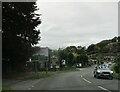
This page details the photographs taken nearby to Sough Lane, S32 3WY by members of the Geograph project.
The Geograph project started in 2005 with the aim of publishing, organising and preserving representative images for every square kilometre of Great Britain, Ireland and the Isle of Man.

There are currently over 7.5m images from over14,400 individuals and you can help contribute to the project by visiting https://www.geograph.org.uk
Image Map
Images are licensed for reuse under creativecommons.org/licenses/by-sa/2.0
Notes
- Clicking on the map will re-center to the selected point.
- The higher the marker number, the further away the image location is from the centre of the postcode.
Image Listing (95 Images Found)
Images are licensed for reuse under creativecommons.org/licenses/by-sa/2.0
Image
Details
Distance
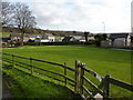
1
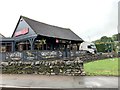
Calver cafe
This is the main meeting point for walkers in this area. This building houses a walkers shop as well as a cafe.
Image: © Roger Temple
Taken: 15 Sep 2007
0.03 miles
2
An Eyre of Importance (10)
Looking from The Eyre Arms towards the Hassop Road
Image: © Basher Eyre
Taken: 19 Aug 2013
0.03 miles
3
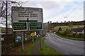
Hassop road into Calver
Calver crossroads.
Image: © steven ruffles
Taken: 2 Feb 2020
0.04 miles
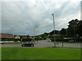
5
Insomnia Cafe
At the Calver Crossroads.
Image: © Andrew Abbott
Taken: 19 Jun 2020
0.04 miles
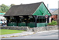
6
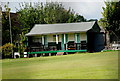
Calver Cricket Club pavilion
The pavilion slopes slightly less than the cricket ground.
Image: © Roger Temple
Taken: 15 Sep 2007
0.04 miles
7
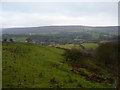
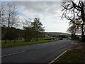
Calver from the path above the Hassop Road
The village further up the hillside is Curbar
Image: © Peter Barr
Taken: 2 Dec 2009
0.04 miles
8
Calver Crossroads
At the junction of the A623 and A625, we have a pub, a shoe shop, a garden centre, a miniature sweetie shop,a cafe, a garage, and an outdoor gear shop
Image: © Peter Barr
Taken: 19 Nov 2009
0.05 miles
9
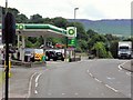
BP Petrol Station, Kingsgate, Calver
Calver is a small village in the Derwent Valley. It is bordered by the River Derwent and intersected by the A623 trunk road, responsible for carrying traffic between Manchester to the west, Sheffield to the north and Chesterfield to the east.
Image: © David Dixon
Taken: 4 Aug 2014
0.05 miles